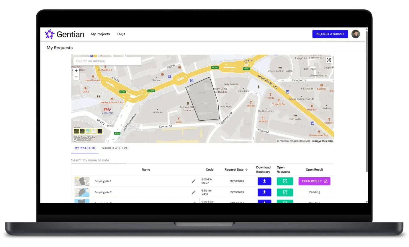
Access the Gentian Online Platform to explore your biodiversity insights in minutes
Log in to the Gentian Online Platform to:
- Download Biodiversity Net Gain (BNG) aligned baseline surveys in minutes
- Request expert-reviewed and detailed habitat mapping for your projects or sustainability reporting
- Access your reports and visualise your nature data, all in one place

Why use Gentian?
Fast, remote & inexpensive
Get surveys without costly or time-consuming field visits, just draw your area to get started.

Highly-accurate data
Be confident that you understand biodiversity risks and opportunities with our expert-backed high-resolution results.

Actionable and compliant
Download ready-made biodiversity reports for your projects, whether for site scoping, sustainability reporting or more.

Our Products

Gentian True Sight
Instant Biodiversity Net Gain (BNG) assessments
Rapid AI-powered habitat mapping software compatible with BNG metrics. Ideal for quick site screening and feasibility studies.
.png?width=952&height=671&name=unnamed%20(4).png)
Gentian True Sage
Detailed habitat assessments and monitoring
Comprehensive biodiversity mapping software with high precision and accuracy, designed for nature-positive reporting, planning, and ongoing monitoring.
.png?width=1349&height=1217&name=Untitled%20design%20(3).png)
Gentian True Oracle
Bespoke enterprise biodiversity intelligence
Tailored AI-driven environmental insights and custom solutions for complex, large-scale ecological and sustainability challenges.
.png?width=2048&height=690&name=unnamed%20(2).png)
Gentian True Urban
Urban green infrastructure analysis
Detailed mapping of urban habitats, green roofs, and climate resilience to support sustainable city planning and development.
Our four pillars

Cost-Efficient & Scalable
Eliminates the need for expensive, manual surveys in many cases.

Unparalleled Accuracy
Sub-meter resolution satellite imagery for precise habitat mapping.

Rapid Delivery
Assessments completed in days or even minutes, not weeks or months.
.png?width=100&height=100&name=icons8-trust-100%20(1).png)
Trusted Data
Reports fully aligned with statutory metrics and checked by our in-house ecological experts for quality.
Explore what makes Gentian a trusted partner
Gentian combines deep ecological expertise with cutting-edge technology to deliver better, faster, and more scalable ecological insights. By combining satellite imagery, AI-powered analysis, and expert review, we provide clear, reliable data to support informed decisions across planning, land management, and sustainability projects. Explore more below.

FAQs
What is the Gentian Online Platform?
The Gentian Online Platform (GOP) is designed to streamline the ordering and delivery of ecological site assessments. It allows users to draw or upload an Area of Interest (AOI), purchase instant habitat mapping surveys across the UK, or request detailed surveys anywhere in the world. All your purchased and pending surveys can be managed in one convenient location under My Projects.
How does the platform work?
- Upload or draw your AOI: Use the ‘Request a Survey’ tool to define your area of interest.
- Choose your product: Select True Sight for an instant habitat survey (for UK locations). Select True Sage for more advanced or international surveys and True Oracle for a bespoke survey request.
- View your results: Completed surveys are stored in ‘My Projects’ for easy access and download.
How quickly can I receive a survey?
For True Sight, results are typically available in 5 minutes, depending on the size and complexity of your site.
For True Sage and True Oracle our team will contact you as soon as possible after your request. Once the project scope is agreed upon, survey results will be delivered through the platform within 10 working days.
How accurate is the data provided?
- True Sight identifies 10+ of the most common UK habitat types, as well as priority habitats.
- True Sage maps 30+ habitat types and is our most accurate survey product.
- True Oracle is a bespoke solution tailored to your project’s specific needs and is handled by our expert team.
How are Gentian’s surveys different from traditional ecological surveys?
Our surveys are conducted remotely using satellite imagery and AI, making them faster, more cost-effective, and available year-round.
Can I use Gentian's data to submit a formal BNG assessment report?
Gentian’s data is ideal for scoping, early feasibility, and risk reduction. While it is not designed for direct submission as a compliant BNG report, it provides a strong foundation for subsequent ecological assessments required for planning approval.
Contact us
Whether you’re scoping a site, shaping a sustainability strategy, or monitoring long-term change, we’re here to help. Let’s explore how Gentian’s tools can support your environmental goals with speed, accuracy, and clarity.