Gentian True Sight: AI Biodiversity Net Gain Software
Gentian True Sight is AI-powered software used for measuring biodiversity net gain. It delivers rapid, AI-powered habitat classifications that are fully compatible with the Biodiversity Net Gain (BNG) metric, providing instant habitat insights for rapid decision-making and site-scoping—fully remote, available within minutes and scalable across multiple sites.
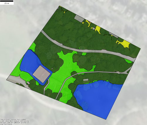
See Gentian True Sight in Action
Discover below how Gentian True Sight provides rapid, AI-powered habitat insights. Fully remote, BNG-compatible, and available in under five minutes.
Try True Sight Now
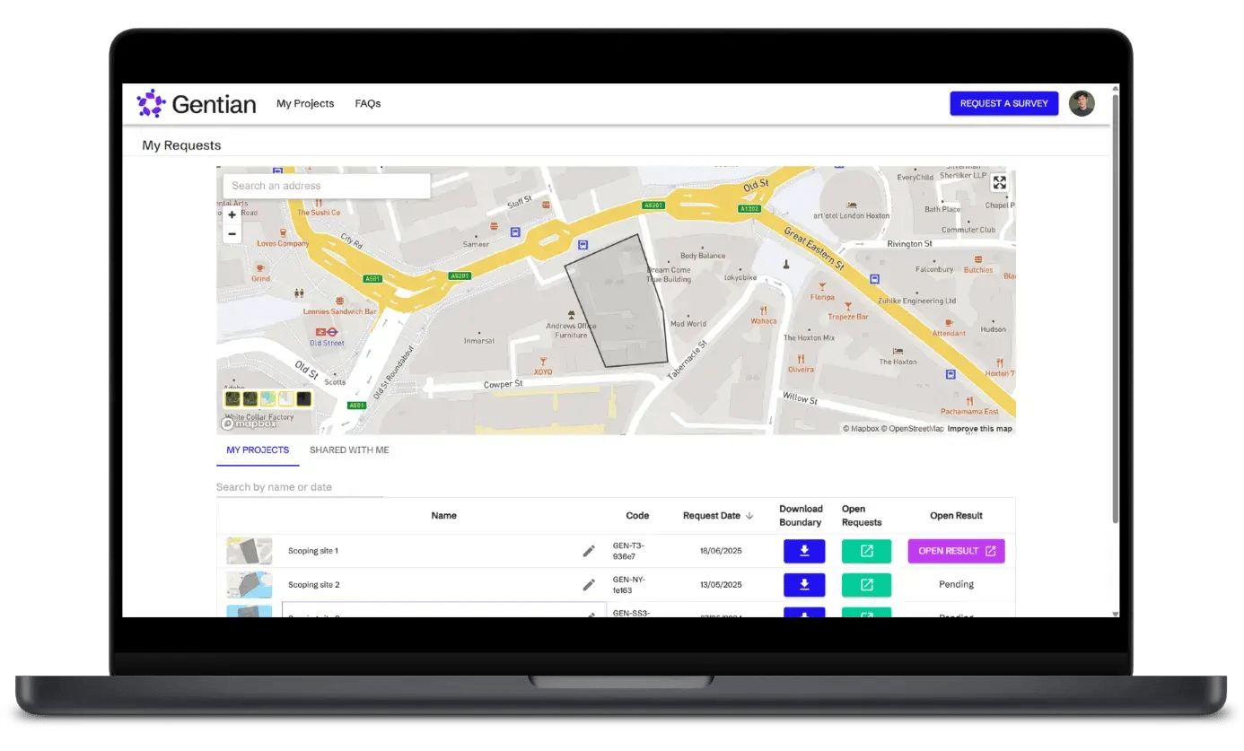
Experience the speed and simplicity for yourself. Log in to the Gentian Online Platform to start your BNG journey today.
- Download BNG-aligned baseline surveys in minutes, at a fraction of the cost of manual assessments
- Ideal for scoping out sites or assessing land early in your project, without waiting weeks
- Access your reports and visualise your nature data, all in one place
Why use Gentian True Sight?

Speed up the BNG site scoping process
Traditional surveys delay the site scoping process. Gentian True Sight delivers AI-powered habitat maps in minutes—fast, approximate, BNG-tailored, and cost-effective.

Reduce costly and slow field surveys
Manual habitat mapping can be expensive and time-consuming. Gentian True Sight provides rapid, remote biodiversity insights, cutting costs while maintaining high accuracy.

Optimise large-scale site monitoring
Surveying and monitoring multiple sites is slow and costly. Gentian True Sight scales effortlessly, delivering accurate habitat maps across entire portfolios in minutes.

Overcome seasonal limitations
Traditional surveys depend on field conditions. Utilising satellite imagery and cutting-edge AI, Gentian True Sight provides consistent biodiversity data anytime, unaffected by seasonality.

Streamline planning & development
Gaps in environmental data delay approvals. Gentian True Sight is a useful tool for calculating biodiversity net gain. It seamlessly integrates into planning workflows, providing instant insights to accelerate decisions and keep projects moving.
AI-driven insights for nature-positive decision making
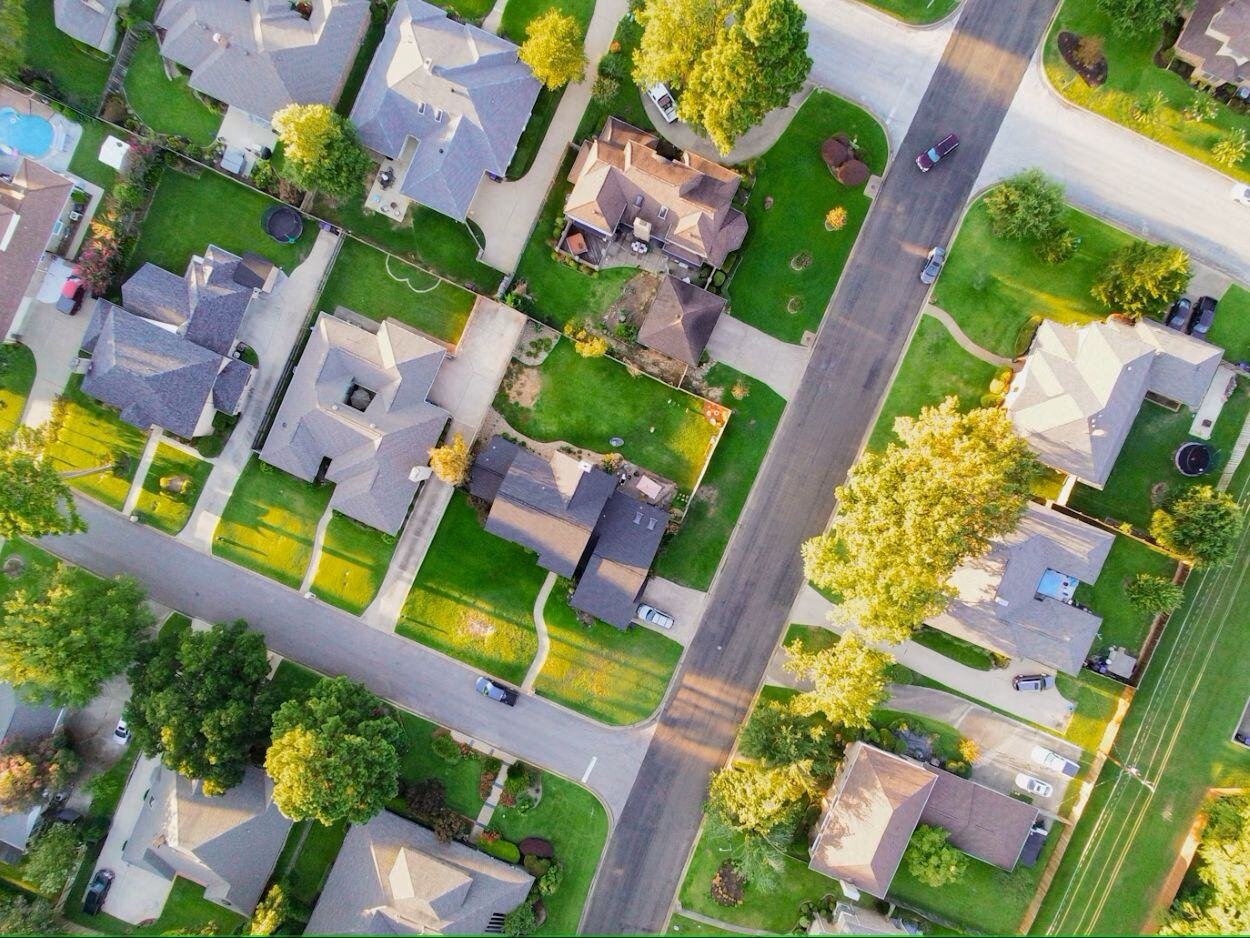
Using aerial and satellite imagery we can achieve what many local authorities may find impossible: remotely mapping out the vegetation cover of private gardens.
Features
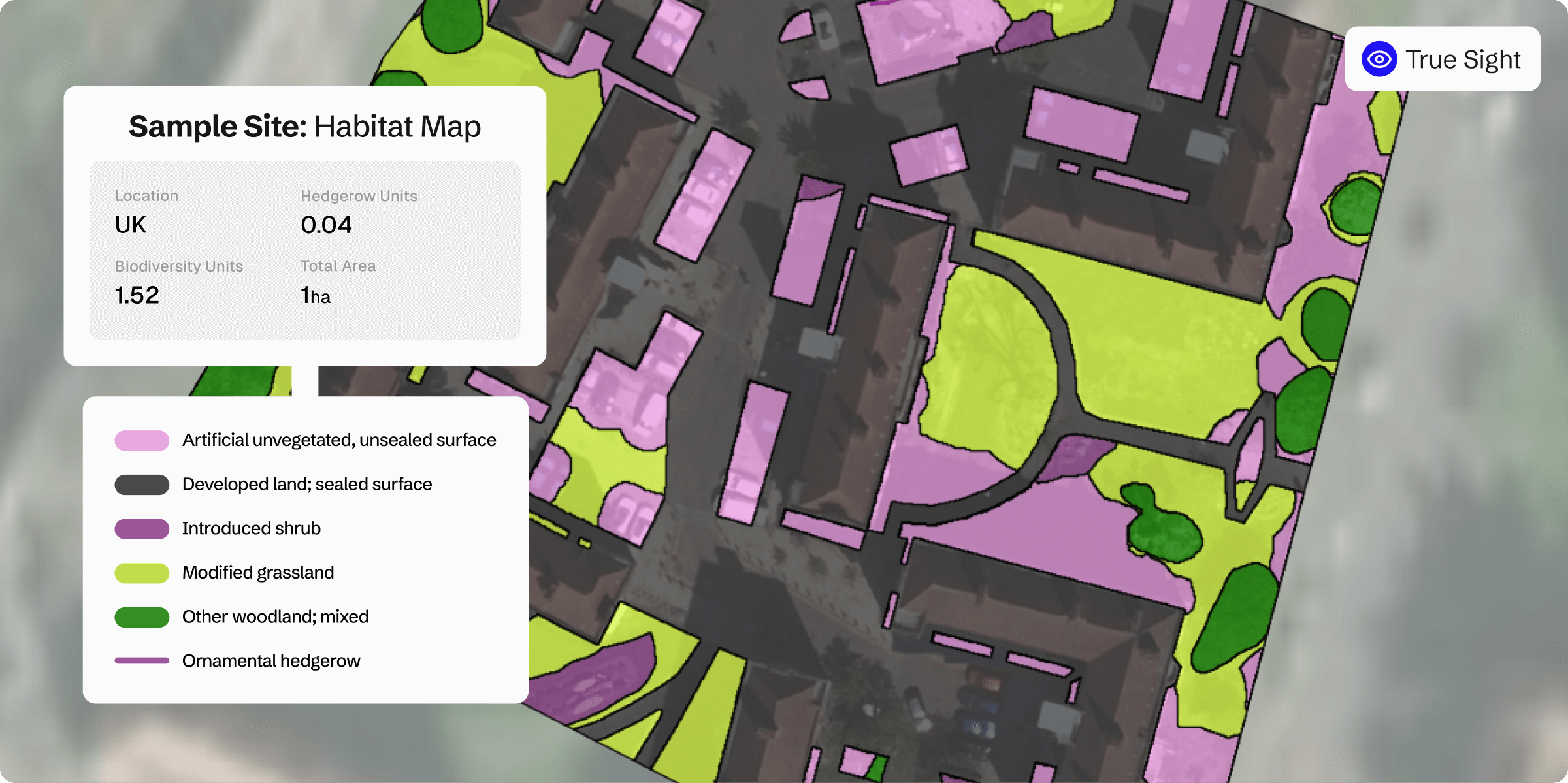
BNG habitat map
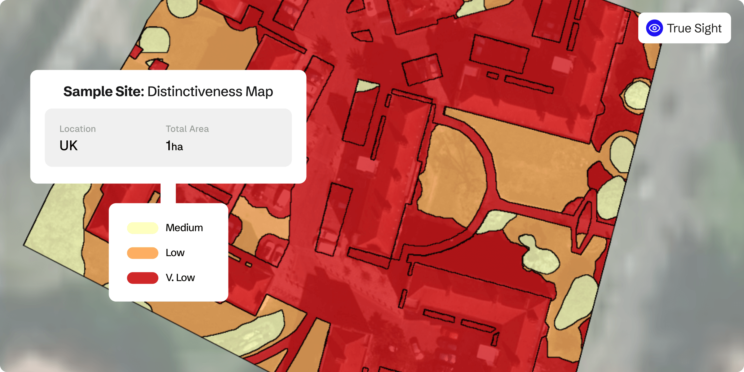
BNG distinctiveness
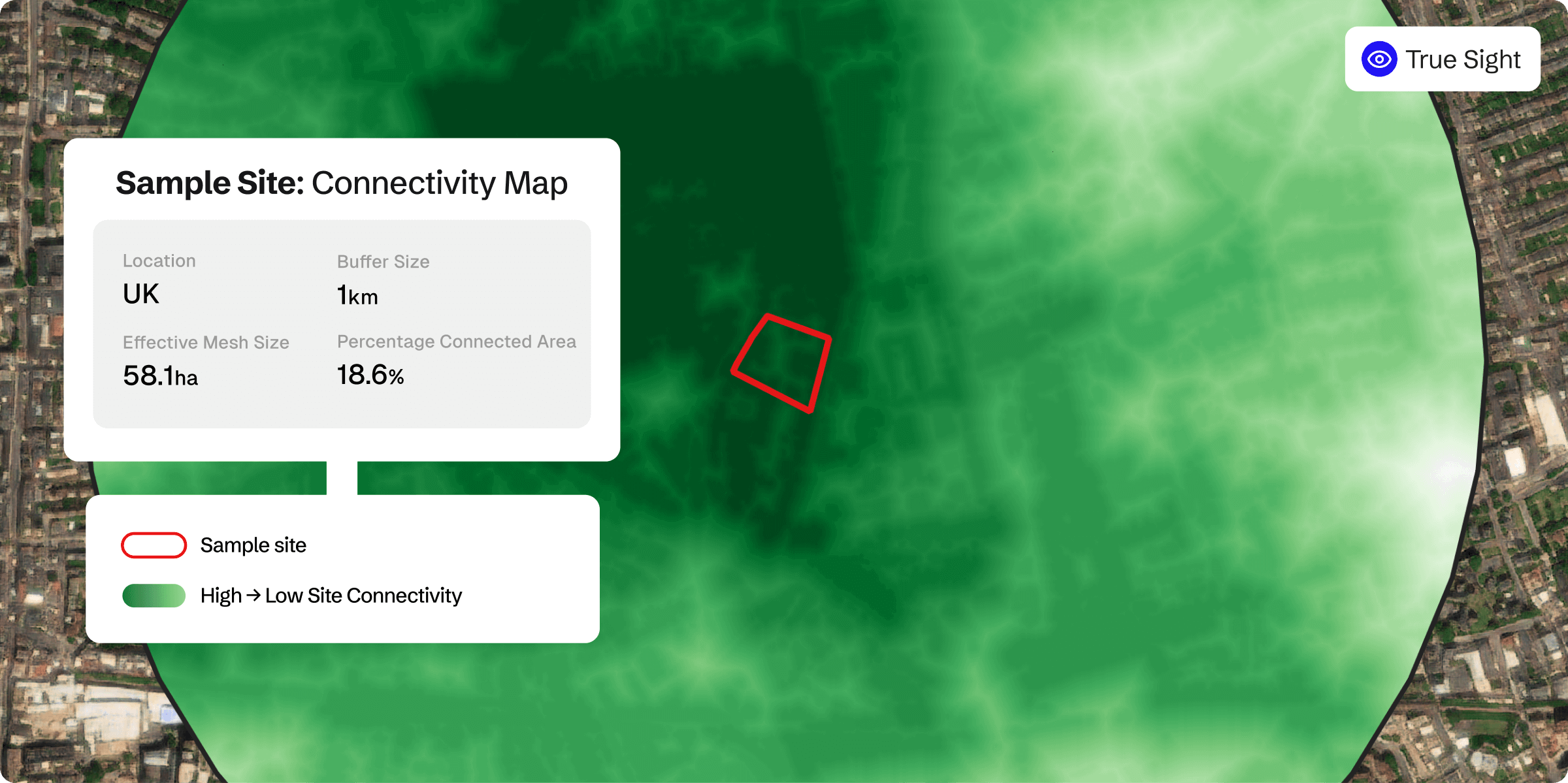
Connectivity heat map
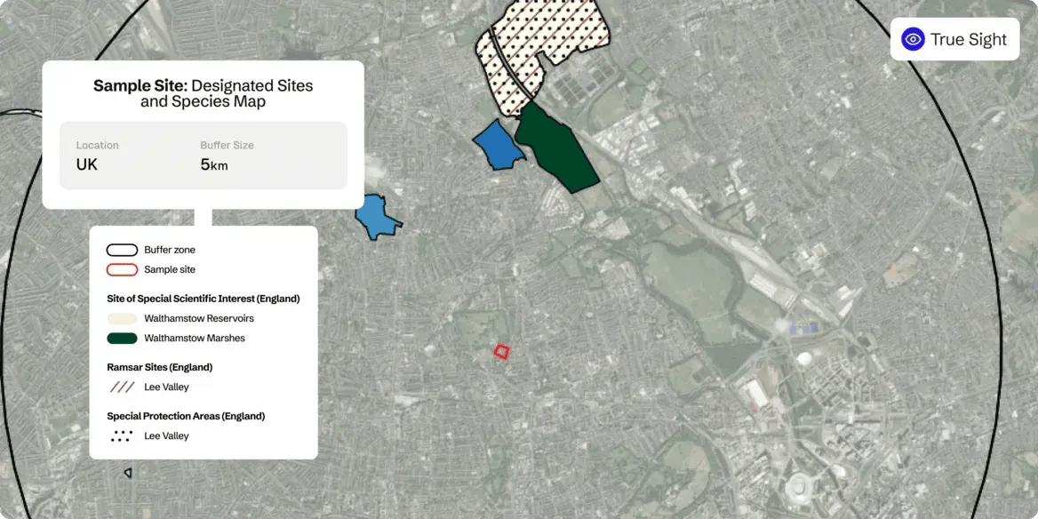
Designated sites and species
Rapid biodiversity insights enable facilities management leader to cut site scoping times significantly
A leading UK facilities management company needed faster, scalable biodiversity assessments. Using Gentian True Sight, they cut site-scoping time, reduced costs, and improved proposals, securing projects over competitors.

Technical specifications
Precision habitat mapping for accurate land assessment
Gentian True Sight leverages up-to-date, high-resolution imagery—captured within the last three years, with precision as fine as 12.5 cm—to deliver accurate habitat boundaries and classifications. This ensures reliable insights for conservation, planning, and biodiversity assessments.
Comprehensive habitat classification with key linear features
Our advanced mapping includes over 35 habitat types, integrating both common and priority habitats. It also captures essential linear features, such as hedgerows and watercourses, providing a complete ecological picture for informed decision-making.
Seamless biodiversity unit calculation for compliance and reporting
Automatically calculate biodiversity unit values with precision using our advanced classification models. This streamlined approach supports regulatory compliance, biodiversity net gain planning, and habitat restoration strategies with minimal manual effort.
API-enabled access for seamless integration
Easily integrate Gentian True Sight’s habitat and biodiversity data into your existing workflows with our API. Gain real-time access to up-to-date insights, ensuring smooth interoperability for planners, developers, and environmental professionals.
Pricing
Gentian True Sight offers transparent and scalable pricing to fit projects of all sizes. Whether you need a single survey or ongoing assessments, choose between pay-per-use for flexibility or prepaid credits for significant cost savings.
| First ha | < 30 ha | 30-100 ha | >100 ha | |
| Pay-per-use | £30 | £12 | £8 | £2 |
| Reseller Pricing |
£25 | £8 | £4 | £1 |
| 2 ha | 5 ha | 10 ha | 30 ha | 75 ha | 100 ha | 1000 ha |
| £42 | £78 | £138 | £378 | £738 | £983 | £2,738 |
| £33 | £57 | £97 | £257 | £437 | £537 | £1,437 |
