Gentian True Sage: AI Biodiversity Assessment & Reporting Software
Gentian True Sage is powerful cloud-based software used for biodiversity assessment and reporting. It delivers precise, AI-powered biodiversity assessments, enabling organisations to map habitats, track ecological changes, and meet compliance needs with unparalleled accuracy and efficiency—fully remote, at speed, and with none of the scalability issues associated with traditional methods.
.png?width=700&height=397&name=unnamed%20(4).png)
Why use Gentian True Sage?

Speed up habitat mapping to reduce costs
Gentian True Sage is biodiversity reporting software that provides rapid, AI-powered habitat mapping. This saves time and ensures accurate nature-related insights in days compared to weeks or months compared with traditional survey methods.
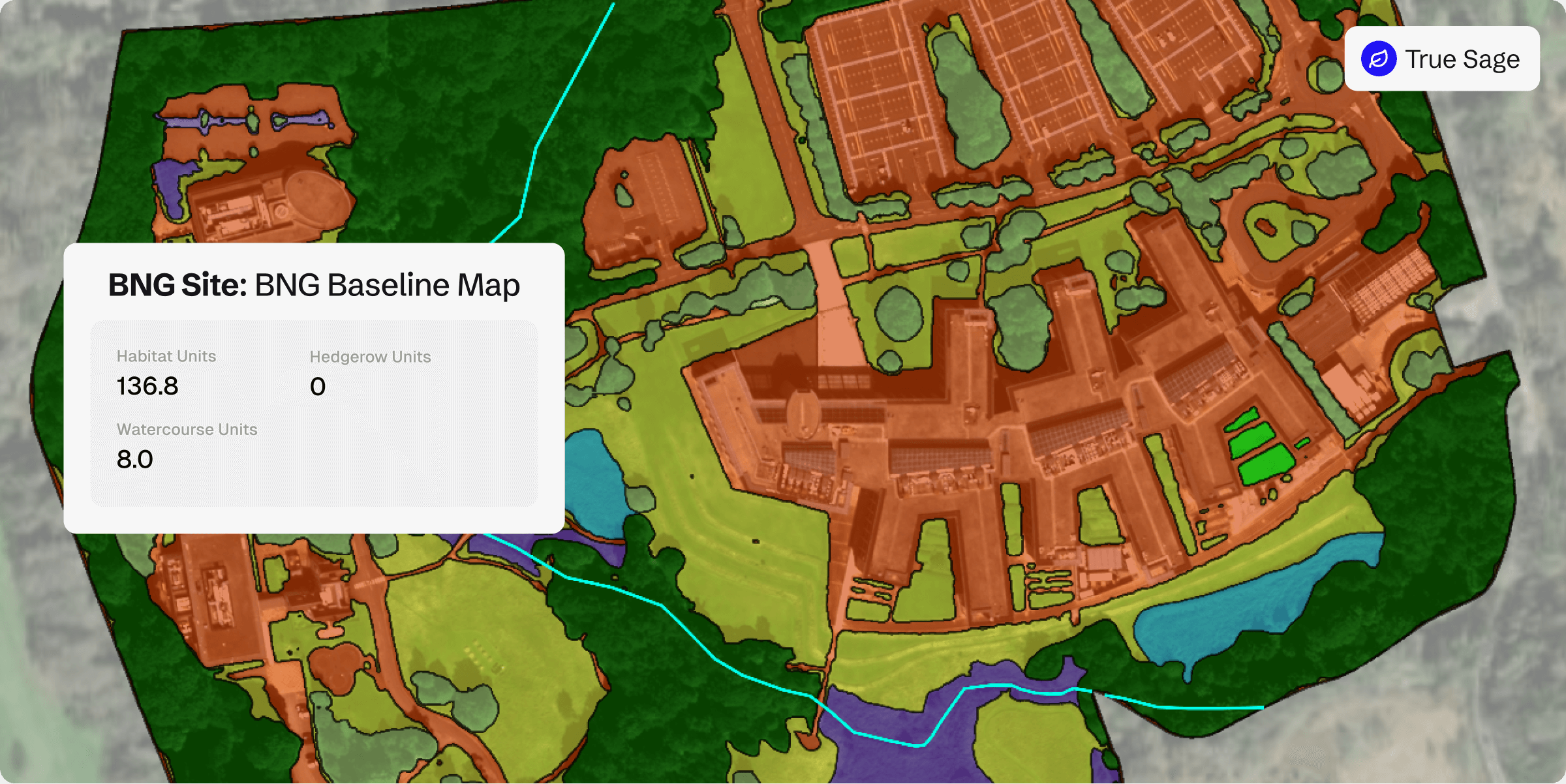
Optimise BNG reporting with precision baselines
Our surveys deliver accurate biodiversity baselines, enabling effective management and uplift of biodiversity net gain (BNG) to assist with reporting and tracking, whether for single sites or entire portfolios.

Ensure compliance
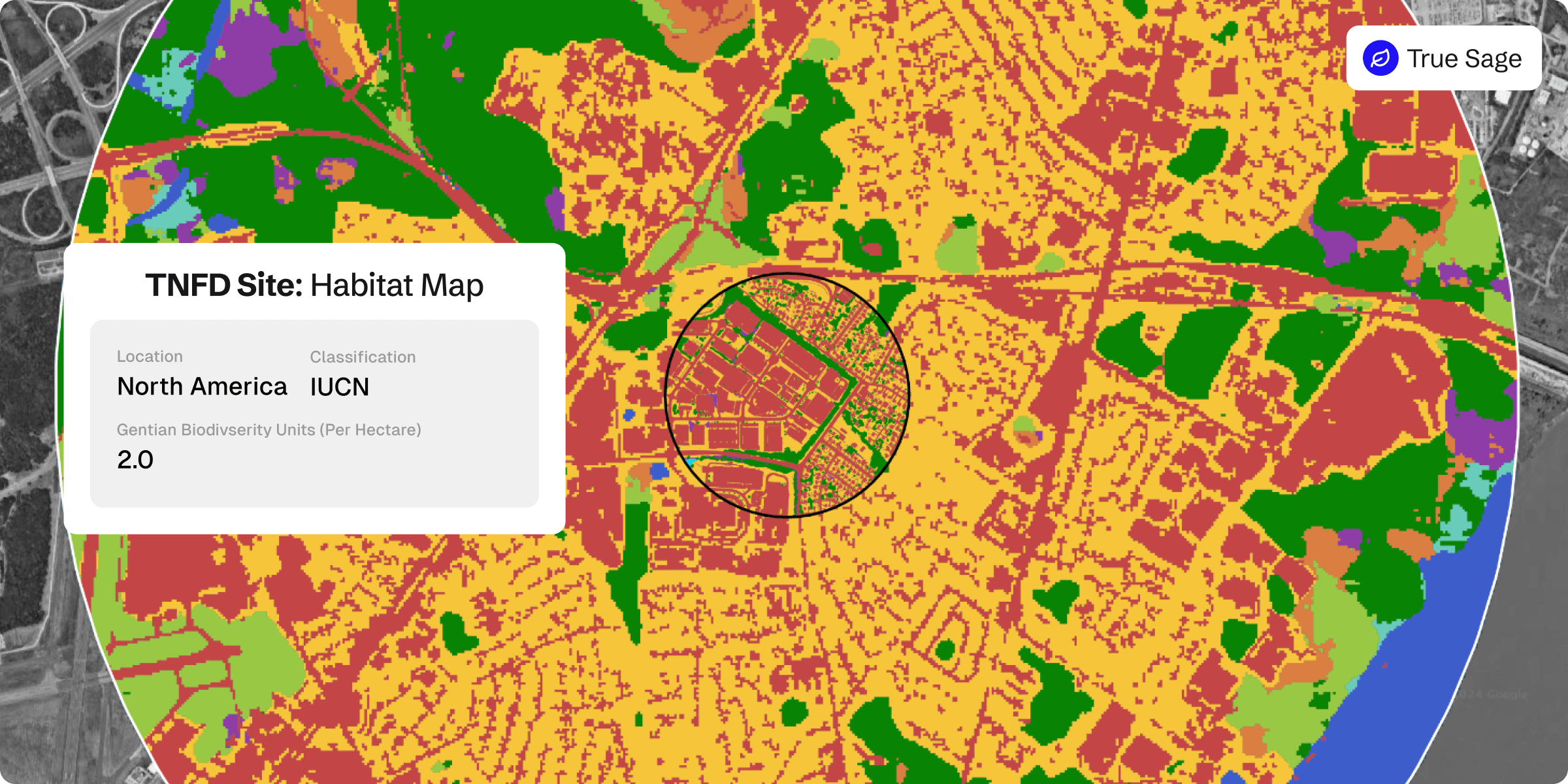
with TNFD and CSRD
Ensure compliance with TNFD, CSRD and other reporting frameworks or regulations effortlessly, through our rapid and remote assessments, reducing reporting risks and administrative burdens.

Monitor biodiversity at scale effortlessly
Surveying multiple sites with conventional on-site methods can be slow and expensive. Gentian delivers habitat mapping remotely, allowing you to measure and monitor nature effortlessly across many locations at once.

Obtain consistent biodiversity data
Field surveys can vary in quality and approach. Gentian True Sage is an effective biodiversity assessment tool that delivers standardised, high-accuracy habitat data for reliable comparisons across sites, without costly fieldwork, logistical challenges, or inconsistent results.

Baseline biodiversity—past and present
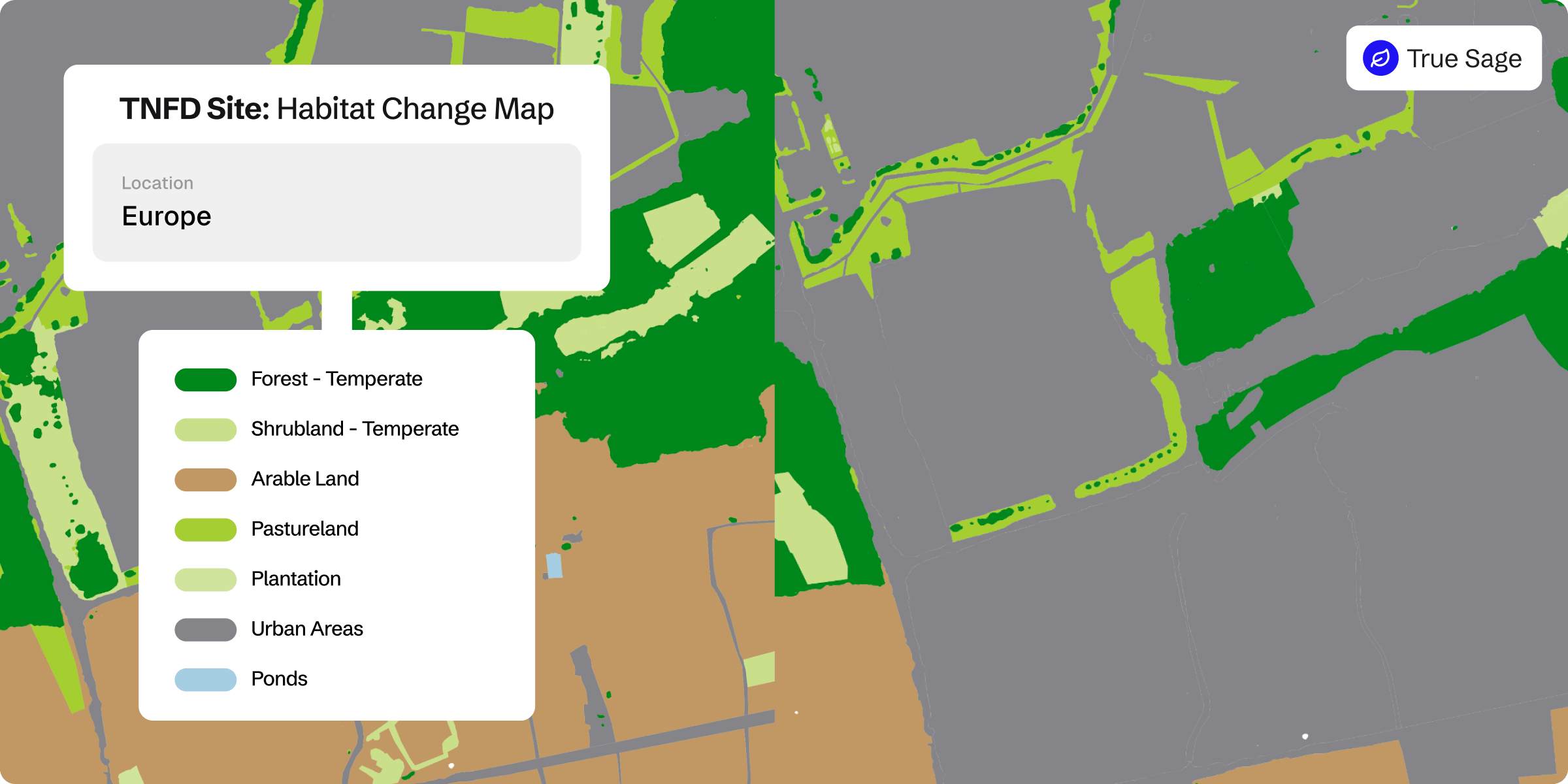
Traditional surveys can’t capture the past. Gentian True Sage can use historical imagery to establish biodiversity baselines anytime, unconstrained by season or survey timing.
Features
BNG habitat map
TNFD habitat map
TNFD change map
Landowner transforms its biodiversity monitoring, demonstrating measurable net gains across 50+ Sites
A large UK cemetery and crematoria operator used Gentian True Sage to map 50+ sites in 90 days, proving a 29-unit biodiversity uplift. The platform cut costs, streamlined reporting, and ensured scalable, evidence-based tracking.
Technical specifications
High-precision habitat mapping with expert validation
Gentian True Sage delivers habitat classifications compatible with BNG, IUCN, and EUNIS standards, covering nearly all habitat types within these frameworks. Every assessment is quality-checked by our expert ecology team to ensure accuracy and reliability.
Comprehensive ecological insights, including key linear features
Capture not only habitats but also hedgerows, watercourses, and individual trees with exceptional detail. This ensures a complete ecological picture for conservation, planning, and biodiversity monitoring.
Up-to-date, high-resolution imagery for accurate assessments
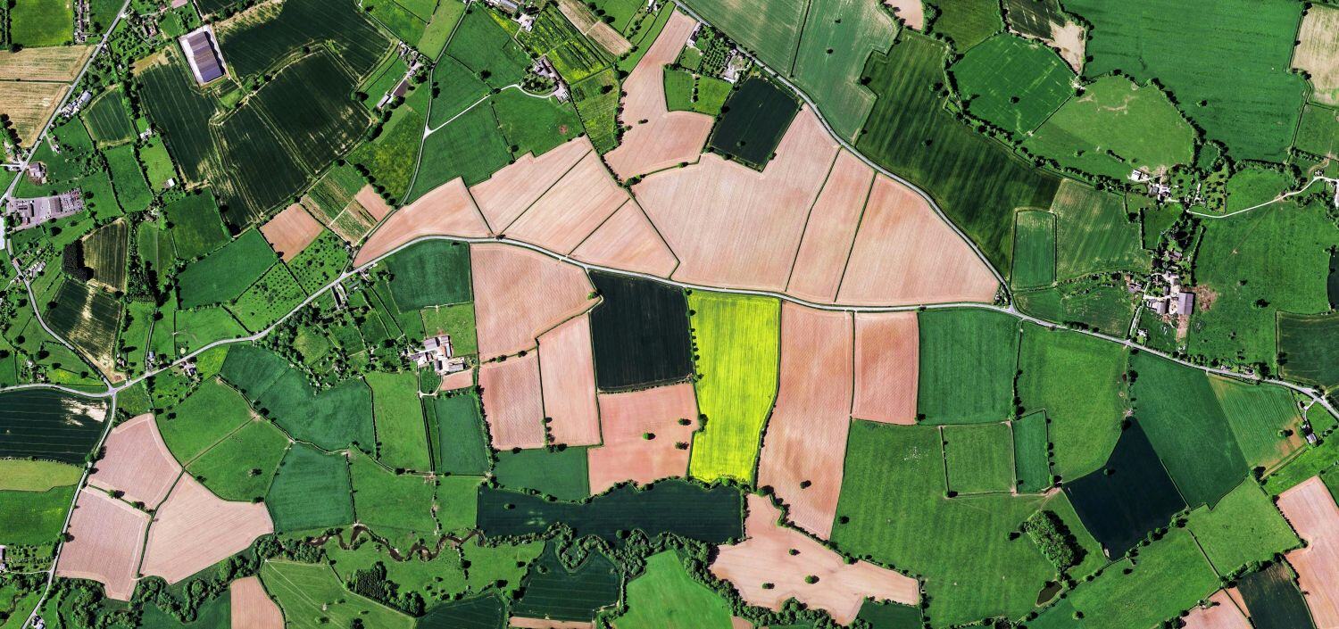
Using less than a year old imagery with resolutions of up to 50cm, Gentian True Sage provides the most current and detailed habitat data available, ensuring that land assessments reflect real-time conditions.
Contact us
Whether you’re scoping a site, shaping a sustainability strategy, or monitoring long-term change, we’re here to help. Let’s explore how Gentian’s tools can support your environmental goals with speed, accuracy, and clarity.