About Us

Gentian exists for nature

Nature-related risk and opportunity are now business-critical. Gentian combines high-resolution Earth observation, AI, and ecological expertise to turn complex landscapes into clear insights you can use, fast. Assess a site, prioritise investment across a portfolio, or report with confidence, all from a consistent evidence base.

alex-siale-qH36EgNjPJY-unsplash_optimized_200

Our purpose, vision and mission

Close-up of a vibrant kingfisher perched on a thin branch against a blurred natural background. The bird features striking blue and turquoise plumage with an orange underbelly and a long, sharp beak, exemplifying the beauty and precision of this iconic river-dwelling bird species.

Our purpose

We believe in empowering humans to understand the truth about nature. 

jan-huber-4OhFZSAT3sw-unsplash (1)

Our vision

We envision a world where new information about nature is accessible to everyone, empowering a global economy that protects biodiversity and recognises the true value of nature. 

Aerial view of high-rise buildings with green rooftops and landscaped terraces. The central complex features neatly arranged garden areas, pathways, and plants, blending urban architecture with sustainable green space in a dense city environment.

Our mission

Our mission is to empower every organisation that impacts nature with tools to see and value habitats they touch in unprecedented ways.

Our story so far

Gentian began with a simple idea: how can we use cutting edge technology to empower ecologists and organisations to better understand nature? This is how it all began.

2020

Gentian is founded

Gentian is founded and successfully undertakes a European Space Agency (ESA) feasibility study to assess whether satellite imagery and artificial intelligence can be used commercially to locate urban green infrastructure such as green roofs.

2021

Commercial traction

Gentian's technology shows commercial viability when we map existing and potential green roof locations in Manchester and Salford city centres to support climate adaptation goals for the Greater Manchester Combined Authority (GMCA).

2021

Habitat mapping added

Gentian conducts a pilot project with a leading UK homes developer to assess biodiversity across undeveloped sites. The project demonstrates our ability to remotely identify habitats using satellite imagery and artificial intelligence, adding habitat mapping to our line-up of solutions.

2023

International expansion

Gentian demonstrates that its technology can be used outside of the UK as it successfully maps green infrastructure locations and habitats in France as well as a tropical island, the first of many international projects to come.

2024

Nominated for the Earthshot Prize

Gentian is nominated for the second year in a row for HRH the Prince of Wales' Earthshot Prize, signalling our growing recognition as a trusted innovator in AI-powered nature intelligence.

2024

World Economic Forum (WEF) recognition

Gentian is recognised by UpLink, the World Economic Forum’s open innovation platform, as a Top Innovator in biodiversity, having been selected as one of the Top 17 global innovators in UpLink’s Biodiversity Challenge.

2025

Gentian selected as a GeoAI winner

GeoAI celebrates UK-based tools and services that utilise EO data through the introduction of innovative solutions within geospatial and AI ecosystems.

Today

Continuing to scale, sector by sector

Gentian continues to expand its reach - now serving councils, developers, ecology consultancies and infrastructure operators across the UK and internationally. With over 2 million hectares mapped to date, the work goes on: building defensible biodiversity data for the teams making decisions about nature every day.

We have been recognised by major organisations as biodiversity leaders

Google for Startups Accelerator logo featuring the multicolored Google wordmark followed by the text
Logo of Uplink featuring a stylised white
the-earthshot-prize
European Space Agency (ESA) logo featuring a stylised dark blue circular emblem with a spiral motif on the left and the lowercase letters
NTC

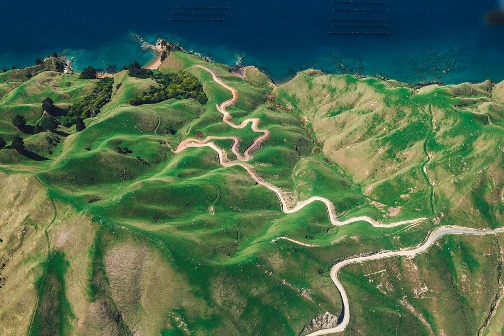
Addressing the biodiversity crisis with data

Gentian turns ecological complexity into clarity. Using high-resolution Earth observation, AI, and deep ecological expertise, we map habitats, track change, and deliver evidence to guide action.

Built to support (not replace) ecologists, we help focus fieldwork, speed early assessments, and strengthen decisions. For local authorities, landowners, developers, infrastructure operators, and corporate sustainability teams, we enable faster, more confident, action aligned with frameworks like TNFD and CSRD - from single sites to whole portfolios.

Screenshot_2025-06-27_150846_optimized_200

Gentian in numbers

ivan-bandura-ipaEhqTMT0Y-unsplash_1_optimized_200
joao-pedro-schmitz-vs6ltDq6Ynk-unsplash (1)
20+
Countries
Gentian has conducted mapping in over 20 countries across 5 continents.
140,000
Hectares mapped in 2025
140,000 hectares mapped at high resolution in 2025.
1,200,000+
Hectares mapped to date
Over 1.2 million hectares mapped to date.

Our four pillars

icons8-world-96

Globally scalable

Apply biodiversity MRV across sites around the world.

icons8-fast-96

Fully remote

No fieldwork delays or seasonal constraints.

icons8-pass-96 (1)

Aligned with frameworks

Output formats compatible with TNFD, SBNTN, and CSRD.

icons8-trust-100 (1)

Trusted expertise

Data reviewed by ecologists and GIS analysts.

Daniel White, CEO
Dan_headshot-1_2_optimized_900
"At Gentian, we believe there are enormous gaps in nature knowledge that can only be filled with AI analyses at scale and speed. By harnessing advanced satellite technology and pioneering AI, together with our partners, we're turning ecological complexity into clarity, ensuring a resilient future for both nature and enterprise."

Why choose Gentian?

Gentian is built for teams that need credible nature intelligence at speed, without compromising on rigour. We combine high-resolution data, transparent methods, and domain expertise to help you move from uncertainty to action, whether you are scoping one site or managing change across thousands.

bernd-dittrich-G4tNFiZecoc-unsplash_optimized_200

Book a meeting with us

Tell us what you are working on and we will point you to the right approach, product, or solution. If it helps, include the geography, the type of sites, and what decision you are trying to make.