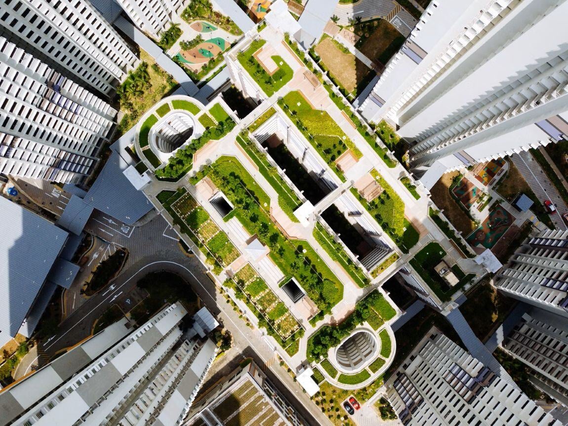
Local government
Gentian helps local authorities map and understand green infrastructure across public and private land, from parks and street trees to green roofs and gardens. Use high-resolution remote sensing to build an up-to-date baseline, identify connectivity and retrofit opportunities, and monitor change over time for nature recovery and flood resilience planning.

.webp?width=1540&height=558&name=GFSA_DigitalBadge_withoutyear_2024%20(1).webp)

.png?width=2000&height=720&name=Hang_Lung_Properties_logo%20(1).png)

Map green infrastructure
- Map parks, street greenery, trees, green roofs, and private gardens in one consistent view.
- Understand where green infrastructure exists today, not where old datasets say it does.
- Support local nature recovery and climate adaptation planning with decision-ready maps.
.jpg?width=1600&height=1199&name=chuttersnap-kNlPgoneOxA-unsplash%20(1).jpg)
Data monitoring & accessibility
- Refresh data year-on-year to track change, progress, and emerging pressure points.
- Share clear outputs that teams can use without GIS expertise or specialist tooling.
- Move from baseline to ongoing monitoring, including uplift and retrofit outcomes.

Data accuracy
- Replace outdated, low-resolution baselines with high-resolution, current insights.
- Improve consistency across wards and years with an objective, repeatable approach.
- Increase confidence in planning and reporting with clearer evidence and fewer assumptions.

Cross-department use
- Provide one dataset that supports biodiversity, flood risk, housing, and public realm teams.
- Reduce siloed working by giving multiple departments a shared source of truth.
- Enable smarter prioritisation when budgets are tight and needs compete.
.jpg?width=2000&height=1333&name=marc-pell-oWRVjFQIwAY-unsplash%20(1).jpg)
Connecting and retrofitting
- Identify high and low connectivity areas to target the best uplift opportunities.
- Pinpoint where retrofits can make a difference, from streets to buildings and estates.
- Support strategies that improve biodiversity while also helping manage storm water.
Scalable pricing for large-scale and cost-saving
- Cost-effective for large boroughs and county councils mapping at scale.
- Save time and spend by reducing reliance on extensive, repeated fieldwork.
- Focus specialist effort on the highest-priority areas, guided by portfolio-wide insights.


Biodiversity Net Gain (BNG) Assessments
Gentian's Biodiversity Net Gain (BNG) Assessments use advanced AI and high-resolution satellite imagery to deliver fast, accurate habitat surveys for site scoping and selection.
.jpg?width=1200&height=900&name=nathan-queloz-uH6aUN38ep8-unsplash%20(1).jpg)
Habitat Mapping
Gentian’s remote habitat mapping solutions combine AI with high-resolution satellite imagery to deliver fast, accurate, and scalable insights across habitat types.
.jpg?width=1800&height=1200&name=paul-summers-ArtVJ-217Cw-unsplash%20(1).jpg)
Biodiversity MRV
Gentian enables organisations to track biodiversity outcomes with clarity and confidence. Our AI-powered MRV solutions deliver accurate, remote assessments of habitat change and ecological condition over time, aligned with TNFD, CSRD, and other global standards.
.jpg?width=1200&height=900&name=joao-pedro-schmitz-vs6ltDq6Ynk-unsplash%20(1).jpg)
Tree Surveys
Gentian delivers fast, remote tree surveys using high-resolution satellite imagery and AI-powered analysis. We help landowners, developers, asset managers and more map canopy cover and estimate tree counts, without the need for boots on the ground.
Summary
Gentian gives local authorities a clear, up-to-date picture of green infrastructure across entire areas, including hard-to-access and private spaces. With high-resolution mapping, connectivity insights, and repeatable monitoring, councils can prioritise interventions, support multiple departments, and deliver more resilient, nature-positive outcomes at scale.
Contact us below to learn how Gentian can support your next project.
.jpg?width=1600&height=1074&name=josephine-baran-cjrULwnJKhI-unsplash%20(1).jpg)