
Gentian True Urban: Urban Habitat Mapping Software
Gentian True Urban is an urban habitat mapping software solution that delivers high-resolution biodiversity and climate resilience insights for towns and cities. Using AI-powered analysis, it maps green spaces, tracks urban habitat change, and supports sustainable planning with precision data.
.png?width=2048&height=690&name=unnamed%20(2).png)
.jpg?width=5760&height=3840&name=mike-benna-SBiVq9eWEtQ-unsplash%20(1).jpg)
Optimise green space planning
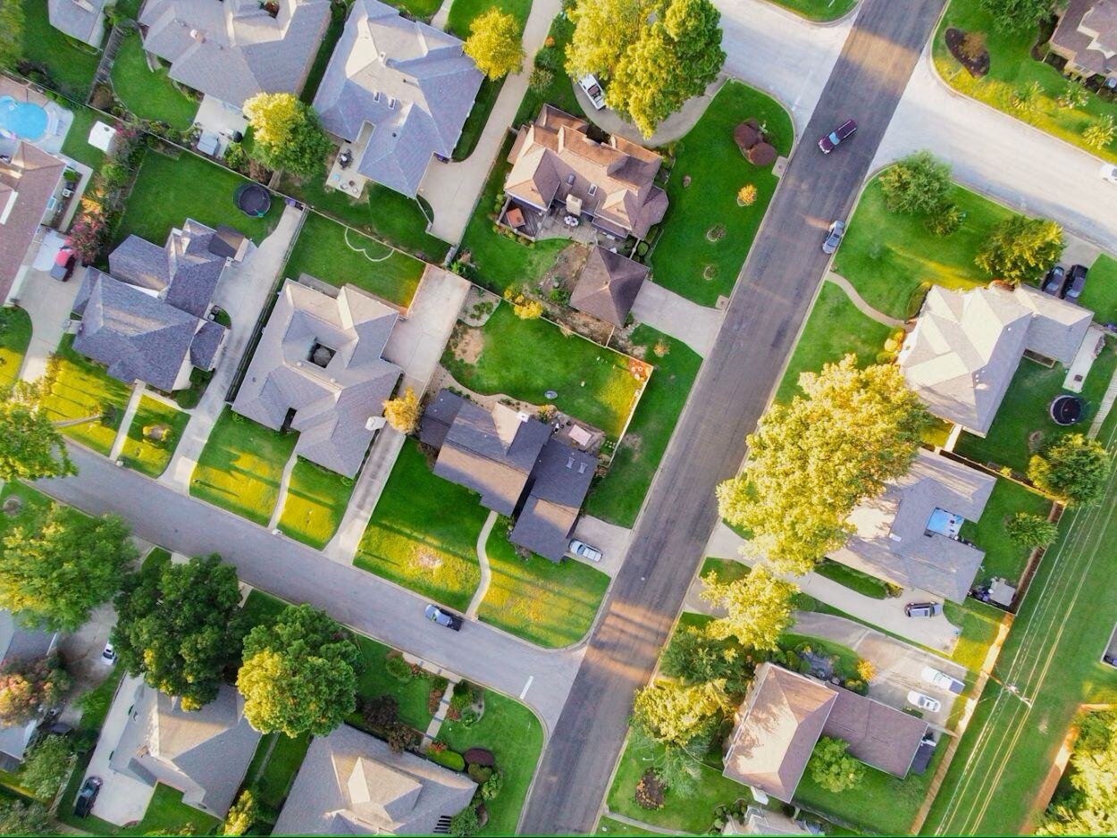
Urban biodiversity is under threat yet poorly mapped. Gentian’s urban habitat mapping software, True Urban, delivers remote, scalable data to enhance climate resilience, green space planning, and ecological health.
.jpg?width=4071&height=2717&name=luiza-giannelli-1RIlmivtNhw-unsplash%20(1).jpg)
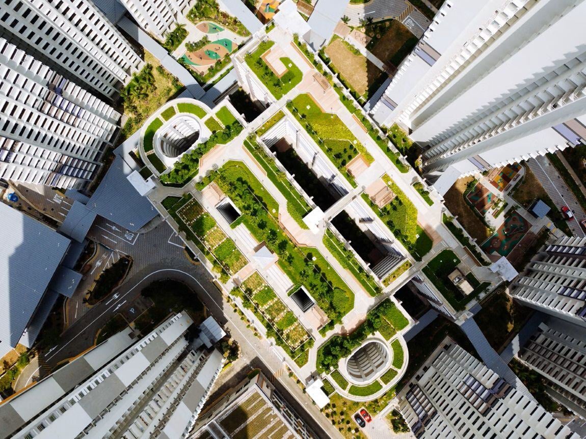
Enhance compliance with sustainability goals
Meeting urban biodiversity and sustainability targets can be challenging. Gentian True Urban automates large-scale urban tree and vegetation mapping, streamlining compliance and reporting at lower costs.

Ensure accurate urban biodiversity data
Many cities and towns lack consistent biodiversity insights. Gentian True Urban software remotely maps urban habitats at scale, providing repeatable, AI-driven data faster and at a lower cost than manual surveys.
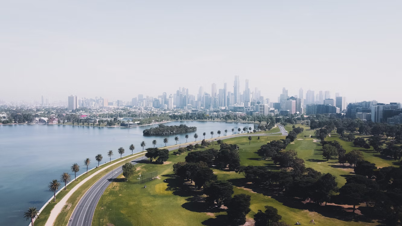
Track urban habitat change over time
Our urban spaces evolve rapidly, making manual tracking impractical. Gentian True Urban provides scalable, repeatable biodiversity monitoring, enabling informed, long-term planning.
Speed up climate resilience strategies
Traditional surveys are slow and costly. Gentian True Urban delivers remote, high-accuracy insights on tree cover, green roofs, urban biodiversity, and more—fast and at scale.
Support smart, sustainable development
Balancing nature with urban growth is tough. Gentian True Urban remotely delivers cost-effective, repeatable biodiversity insights to integrate green infrastructure into city planning.
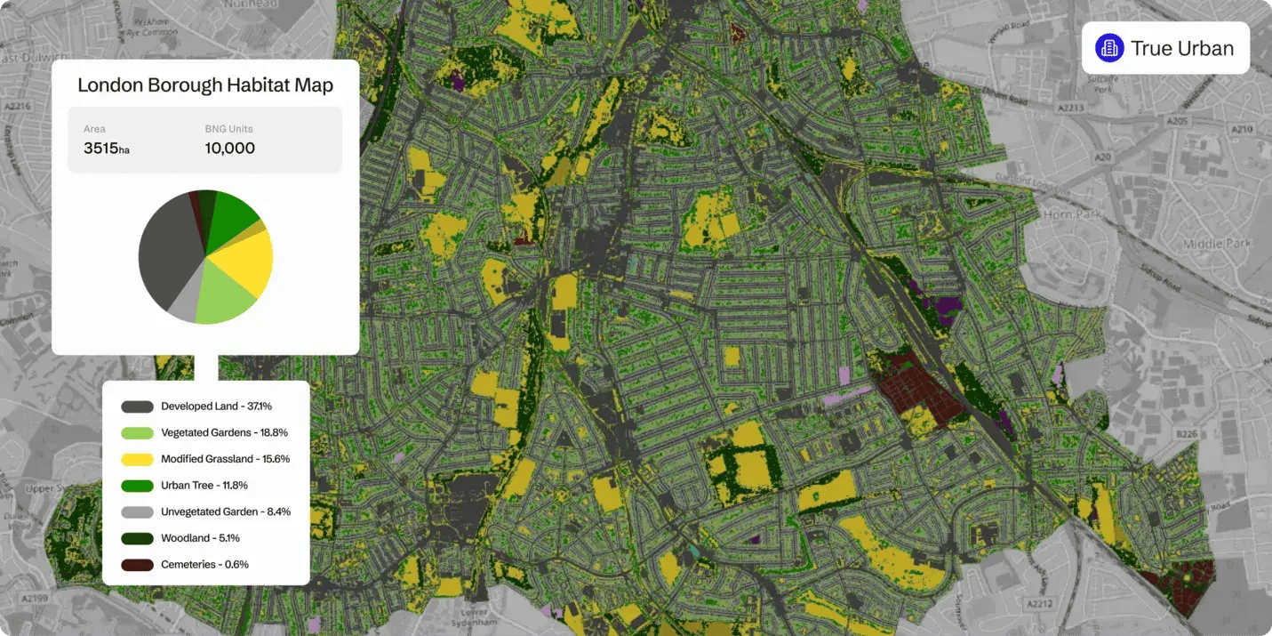
Habitat map
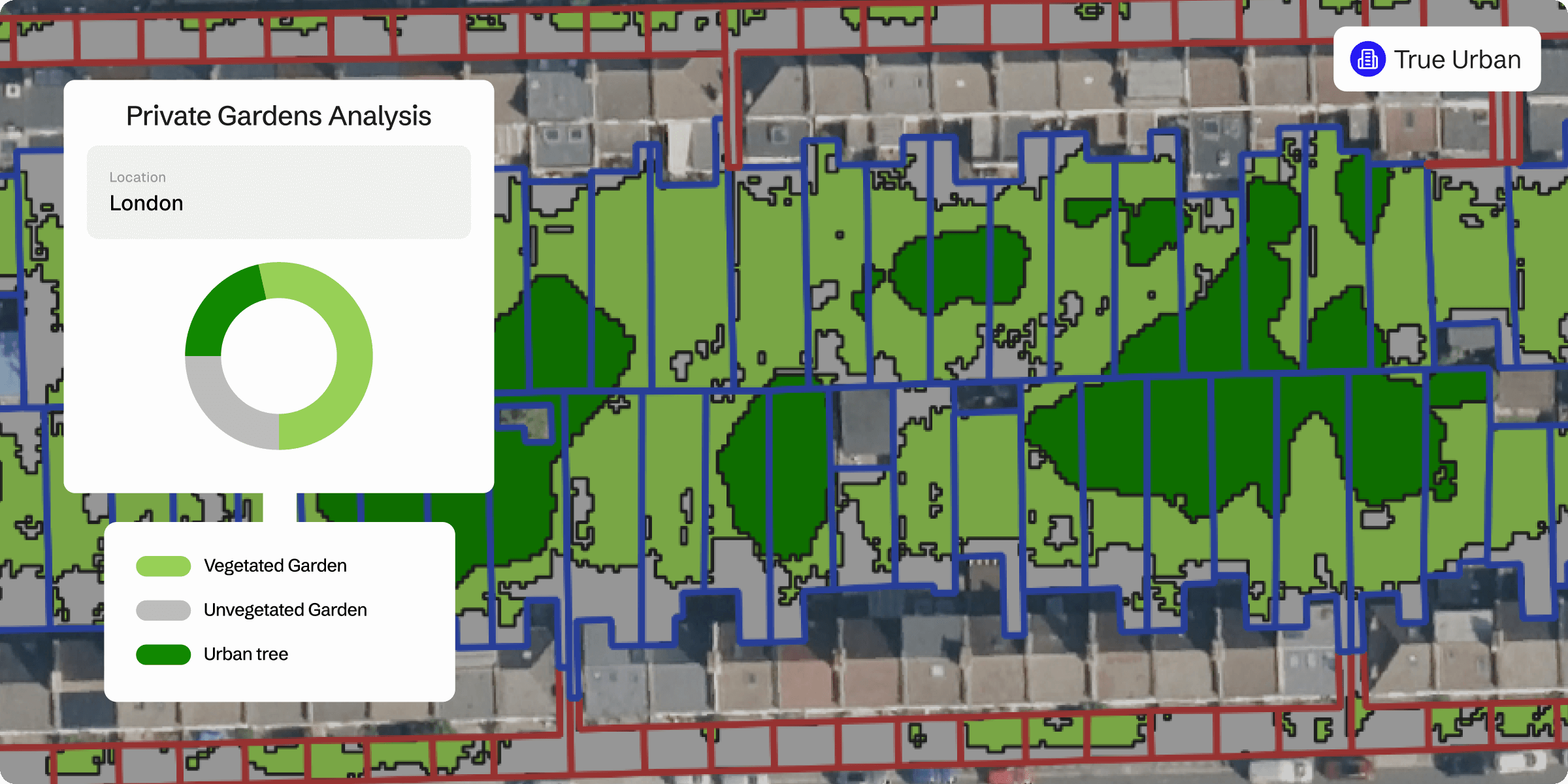
Private gardens
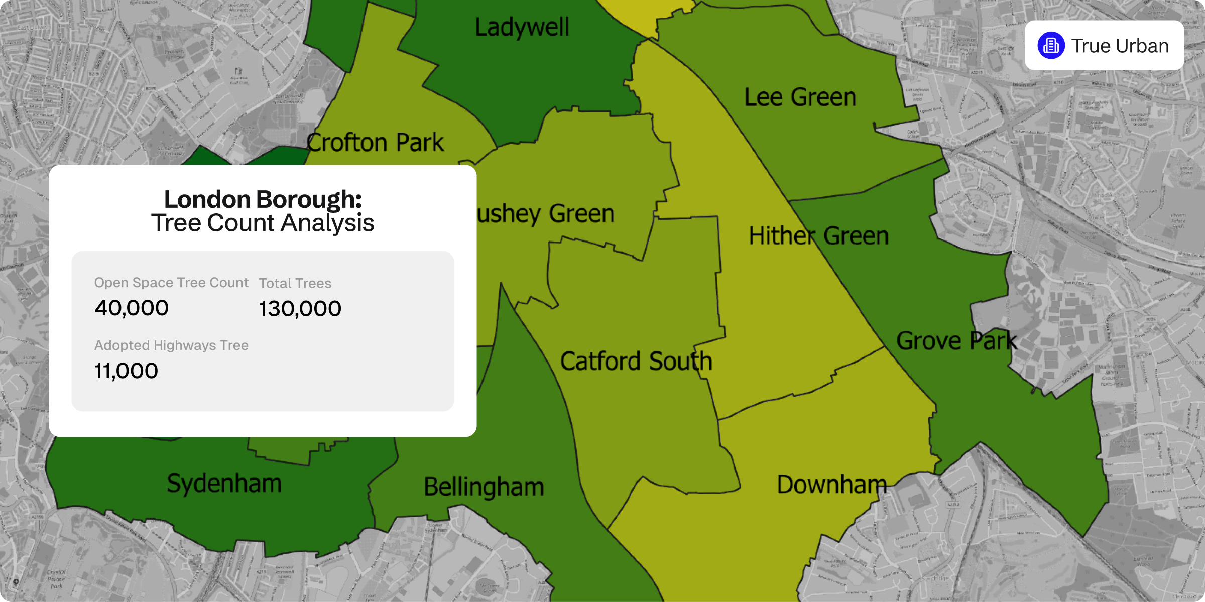
Tree count
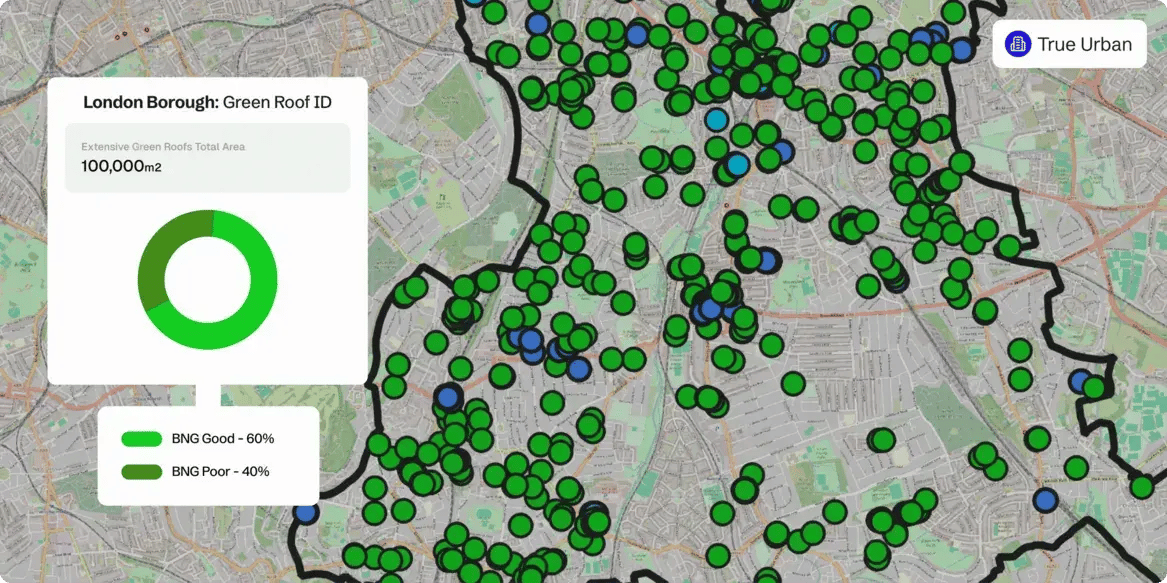
Green roof identification
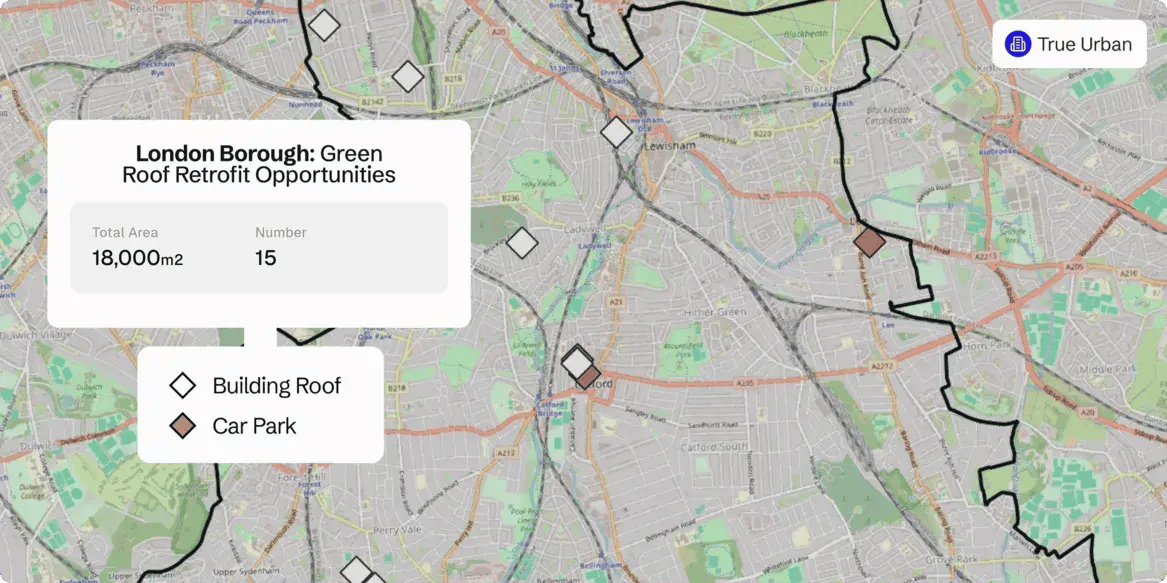
Green roof retrofit opportunities
Detailed urban habitat mapping for smarter planning
True Urban, Gentian’s urban habitat mapping software, delivers comprehensive tree and vegetation mapping tailored to the complexities of urban environments. From parks and street trees to green roofs and private gardens, our insights help cities enhance biodiversity and climate resilience.
High-resolution insights with green roof potential assessment
Using 30 cm or finer high-resolution imagery, True Urban not only maps existing green infrastructure but also identifies potential sites for green roof retrofits, supporting urban greening and sustainability initiatives.
Integrated data layers for informed decision-making
Overlay habitat data with key urban infrastructure layers—including council buildings, adopted highways, and land ownership boundaries—to provide a holistic understanding of nature in the built environment.
Actionable intelligence for resilient cities
True Urban equips planners, developers, and policymakers with the data needed to design greener, more sustainable cities. By integrating habitat insights with urban infrastructure, it enables evidence-based decisions that support biodiversity and climate adaptation.