Phase 1 Habitat Surveys
Gentian delivers remote Phase 1 Habitat Surveys using AI and high-resolution satellite imagery, providing rapid, cost-effective alternatives to traditional field-based assessments. Whether for early-stage scoping, risk screening, or desktop baselines, our surveys provide accurate habitat insights aligned to standard classifications.

How our Phase 1 Habitat Surveys work
Gentian uses high-resolution satellite imagery and proprietary AI to deliver fast, remote Phase 1 Habitat Surveys at scale.
We classify habitat types using Phase 1 categories, cross-referenced with UK Habitat Classification (UKHab) and Biodiversity Net Gain (BNG) metrics for added relevance.
Our data supports early-stage planning, feasibility, and biodiversity screening, helping identify ecological constraints and inform where more detailed surveys may be required.
-1.png?width=1705&height=1202&name=True%20Sage%20Graphic%20One%20(1)-1.png)
Define your area
Upload your site boundary or draw it on our online platform.
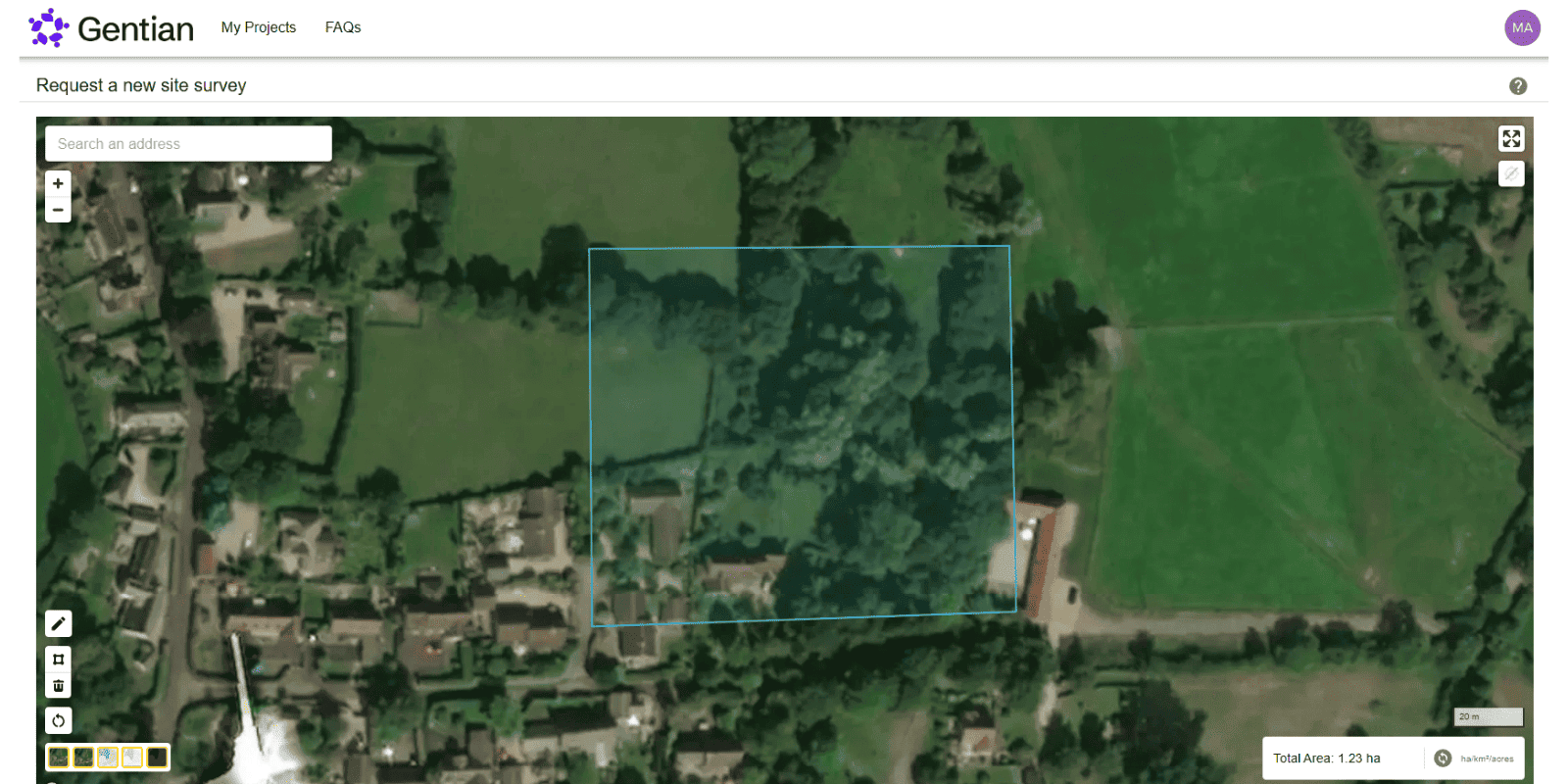
AI-powered habitat classification
Our models identify key habitat types and landscape features.
Receive your insights
We deliver shapefiles, summary maps, and habitat tables for planning, scoping, or desktop reporting.

What is a Phase 1 Habitat Survey?
A Phase 1 Habitat Survey is a standardised method for classifying and recording semi-natural habitats in the UK, originally developed by the Nature Conservancy Council. It uses a colour-coded mapping system to categorise habitats such as grasslands, woodlands, wetlands, and scrub. This survey provides an essential ecological baseline for planning applications, development assessments, land management strategies, and conservation work, helping identify potential ecological constraints and guiding the need for further specialist surveys.
.jpg?width=2200&height=1466&name=magda-vrabetz-8EXkwW9VQ78-unsplash%20(1).jpg)
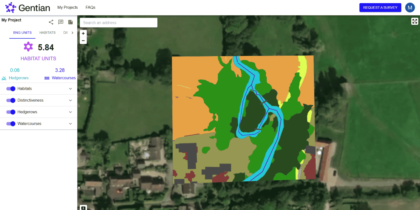
What Does Gentian's Phase 1 Habitat Survey Include?
- Habitat map in the recognised Phase 1 format
- Linear features (such as hedgerows and watercourses)
- Area and percentage calculations by habitat type
- Integration with UKHab or BNG metrics where needed
.jpg?width=1600&height=1074&name=josephine-baran-cjrULwnJKhI-unsplash%20(1).jpg)
Why Use Remote Phase 1 Surveys?
Traditional Phase 1 surveys require seasonal field visits. Gentian delivers a fast, accurate and fully-remote alternative that can support:
- Early-stage site scoping & selection
- Feasibility studies
- Biodiversity and ESG baselining
- Strategic land planning
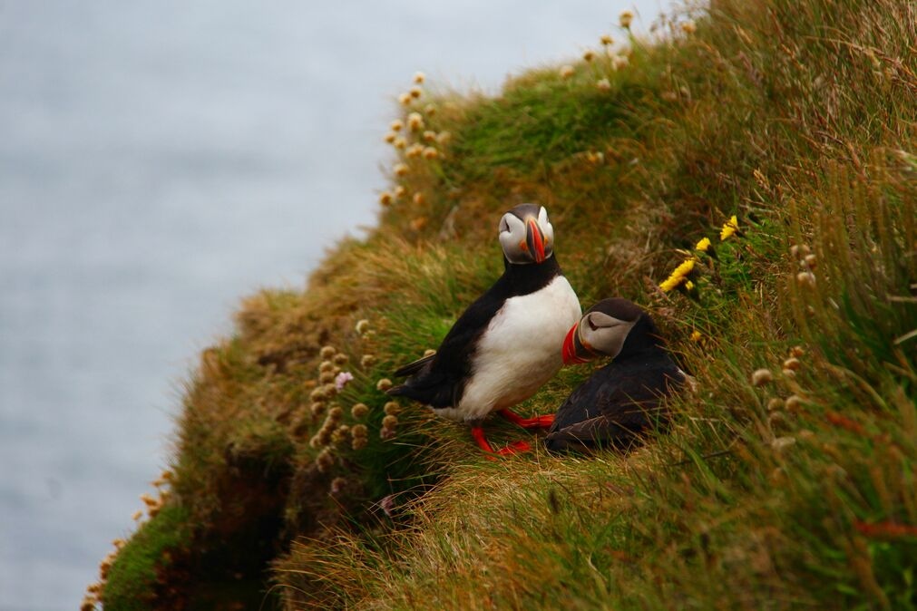
.jpg?width=1600&height=1199&name=chuttersnap-kNlPgoneOxA-unsplash%20(1).jpg)
Are Remote Surveys Suitable for Planning?
Our outputs support early decision-making, reduce risk, and identify potential ecological constraints. While they don’t replace protected species or ground-level ecological reports, they significantly accelerate the path to full surveys and planning applications by providing instant, reliable insights that inform site selection, de-risk investments, and guide ecological strategy from the outset.
.jpg?width=2000&height=1331&name=may-hagen-ha9eQ2l8vms-unsplash%20(1).jpg)
Why choose Gentian?
Our remote approach enables fast, flexible, and consistent ecological assessments. By eliminating the need for on-the-ground fieldwork, we significantly reduce delays, costs, and logistical barriers, without compromising on data quality. This makes our solution ideal for early-stage planning, strategic land acquisition, and portfolio-scale biodiversity analysis.
.jpg?width=2000&height=1330&name=guillermo-riquelme-hFBwVNkEnWg-unsplash%20(1).jpg)

Instant Access
No wait for fieldwork. Get insights in days or even minutes.

Scalable
Survey one site or a hundred.
.png?width=100&height=100&name=icons8-trust-100%20(1).png)
Trusted Frameworks
Data aligned with Phase 1, UKHab, and Biodiversity Net Gain (BNG).

Expertise
AI built by experts, outputs reviewed by ecologists.
Landowner transforms its biodiversity monitoring, demonstrating measurable net gains across 50+ Sites
A large UK cemetery and crematoria operator used Gentian True Sage to map 50+ sites in 90 days, proving a 29-unit biodiversity uplift. The platform cut costs, streamlined reporting, and ensured scalable, evidence-based tracking.

.png?width=1540&height=558&name=GFSA_DigitalBadge_withoutyear_2024%20(1).png)


Biodiversity Net Gain (BNG) Assessments
Gentian’s Biodiversity Net Gain (BNG) Assessments use advanced AI and high-resolution satellite imagery to deliver fast, accurate habitat surveys for site scoping and selection.
.jpg?width=1800&height=1200&name=joel-holland-TRhGEGdw-YY-unsplash%20(1).jpg)
Ecological Surveys
Gentian delivers high-resolution, AI-powered ecological surveys that are faster, more scalable, and cost-effective—offering reliable insights to support planning, land management, and sustainability goals.
Biodiversity Monitoring, Reporting and Verification (MRV)
Our AI-powered MRV solutions deliver accurate, remote assessments of habitat change and ecological condition over time, aligned with TNFD, CSRD, and other global standards.
.jpg?width=1600&height=1067&name=claudel-rheault-ZVbv1akA-l4-unsplash%20(1).jpg)
Habitat Mapping
Gentian uses AI and satellite imagery to map habitats with speed and accuracy. Ideal for baselines, monitoring, or biodiversity risk insights—giving you a clear view of the landscape.