Remote Tree Surveys
Gentian delivers fast, remote tree surveys using high-resolution satellite imagery and AI-powered analysis. We help landowners, developers, asset managers and more map canopy cover and estimate tree counts, without the need for boots on the ground.

How our tree surveys work
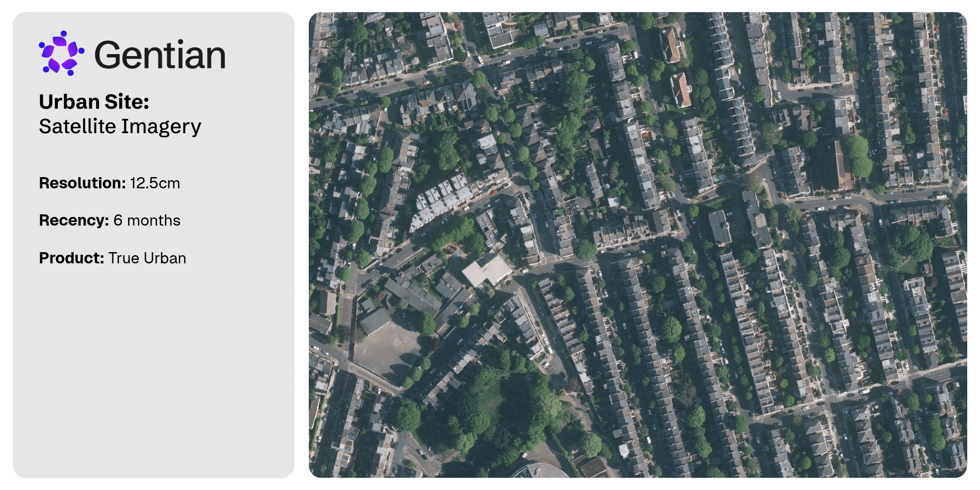
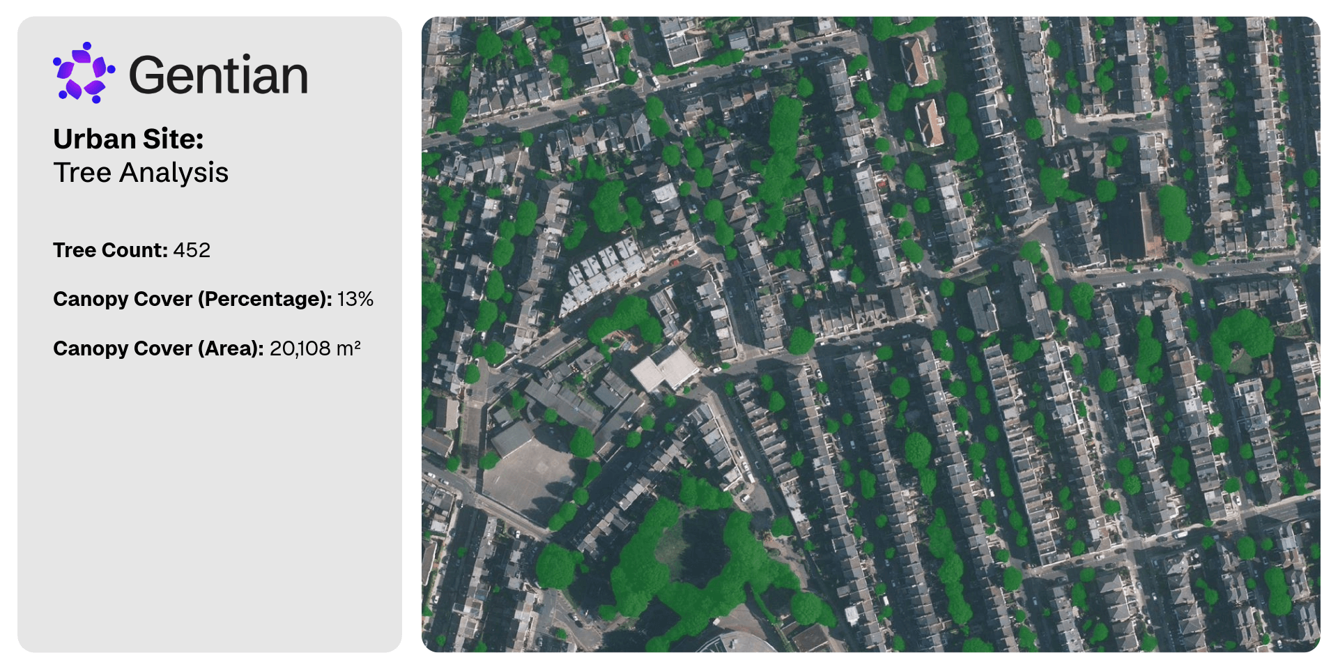
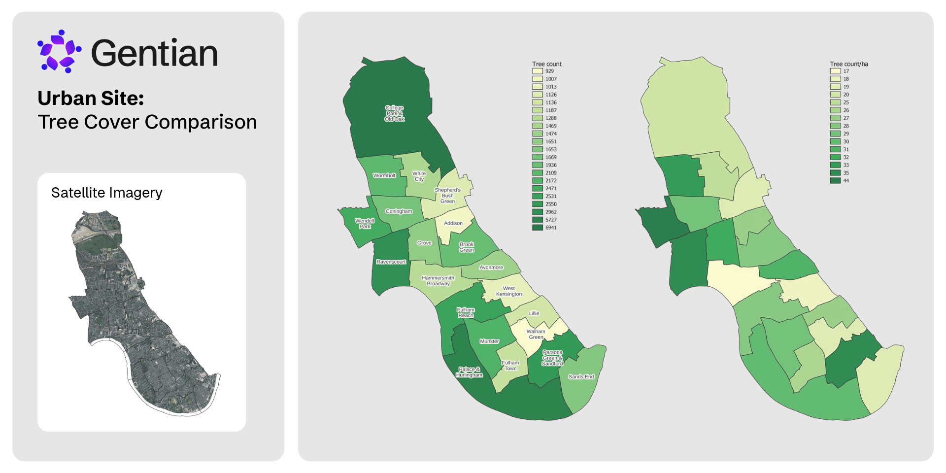
Gentian uses sub-50cm resolution satellite imagery and proprietary AI to deliver fast, remote tree surveys with exceptional accuracy. We map canopy cover and estimate tree counts across urban, rural, or other natural settings.
Our models detect individual tree features where resolution allows and produce clear spatial outputs for planning, biodiversity assessments, and green infrastructure strategies.
Built for flexibility, our data supports ESG reporting and nature-related frameworks like TNFD, empowering organisations to understand, manage, and report on tree cover at scale.
%20(1).png?width=1024&height=768&name=Untitled%20(6)%20(1).png)
Define your area
Upload or draw your site boundary.
Remote sensing and analysis
Our models estimate tree count and map canopy cover.
Get your insights
We deliver maps, spreadsheets, and GIS-ready data.
What is a tree survey for?
A tree survey is used to inform planning, development, and environmental decision-making. It helps identify the presence and extent of tree cover, assess potential ecological constraints, and guide compliance with urban greening targets, conservation regulations, or monitoring requirements.
Gentian’s remote tree surveys are ideal for scoping sites, supporting baseline assessments, managing green infrastructure, and contributing to ESG or TNFD-aligned reporting.
.jpg?width=1000&height=605&name=jan-huber-4OhFZSAT3sw-unsplash%20(1).jpg)
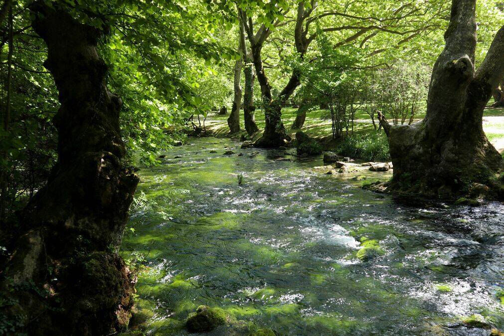
Why is a tree survey important for biodiversity?
Trees play a vital role in supporting biodiversity by providing habitat, food, and shelter for a wide range of species. They contribute to ecological connectivity, regulate microclimates, and enhance soil and water health, making them critical components of functioning ecosystems.
A tree survey helps quantify these natural assets. By understanding tree distribution, canopy cover, and changes over time, land managers and developers can make more informed decisions that protect and enhance biodiversity.
How Gentian can help with your tree survey report
Gentian provides fast, remote tree surveys using sub-50cm satellite imagery and advanced AI models. We deliver accurate data on estimated tree count and canopy coverage, without the delays or logistics of on-site visits.
Our outputs are provided as clear maps, spreadsheets, and GIS-ready files, making them easy to integrate into planning reports or ESG disclosures. Whether you're surveying a single site or a national portfolio, we help you generate high-quality, actionable tree data, quickly and at scale.
.jpg?width=700&height=467&name=mike-benna-SBiVq9eWEtQ-unsplash%20(1).jpg)
Why choose Gentian?
Gentian combines cutting-edge satellite imagery with expert-built AI to deliver accurate, remote tree surveys in days, not weeks or months. Our approach eliminates the need for costly, time-consuming fieldwork while still providing the data you need to make informed decisions.
We offer sub-50cm resolution, scalable coverage across any landscape, and outputs designed for planning, ESG reporting, and green infrastructure strategies. With clear deliverables, expert support, and proven results, Gentian is the trusted choice for fast, flexible, and reliable tree surveys.
.jpg?width=2000&height=1333&name=k8-glEq5uPpBQs-unsplash%20(1).jpg)

Cost-efficient & scalable
Eliminates the need for expensive, manual field surveys.

Rapid delivery
Assessments completed in days or even minutes, not weeks or months.

Unparalleled accuracy
Sub-meter resolution satellite imagery for precise habitat mapping.
.png?width=100&height=100&name=icons8-trust-100%20(1).png)
Trusted data
Reports fully aligned with statutory metrics and checked by our in-house ecological experts for quality.
.png?width=1540&height=558&name=GFSA_DigitalBadge_withoutyear_2024%20(1).png)


.jpg?width=1800&height=1200&name=joel-holland-TRhGEGdw-YY-unsplash%20(1).jpg)
Ecological Surveys
Gentian delivers high-resolution, AI-powered ecological surveys that are faster, more scalable, and cost-effective—offering reliable insights to support planning, land management, and sustainability goals.
.jpg?width=1600&height=1067&name=claudel-rheault-ZVbv1akA-l4-unsplash%20(1).jpg)
Habitat Mapping
Gentian uses AI and satellite imagery to map habitats with speed and accuracy. Ideal for baselines, monitoring, or biodiversity risk insights—giving you a clear view of the landscape.

Biodiversity Monitoring, Reporting and Verification (MRV)
Our AI-powered MRV solutions deliver accurate, remote assessments of habitat change and ecological condition over time, aligned with TNFD, CSRD, and other global standards.

Phase 1 Habitat Surveys
Gentian delivers remote Phase 1 Habitat Surveys using AI and high-resolution satellite imagery—providing rapid, cost-effective alternatives to traditional field-based assessments, whether for early-stage scoping, risk screening, or desktop baselines.