
Gentian True Sage: AI Biodiversity Assessment & Reporting Software
Gentian True Sage is a powerful cloud-based platform for biodiversity assessment and risk reporting. It delivers precise, AI-driven insights, empowering organizations to map habitats, mitigate climate risk, and ensure TNFD alignment with unmatched accuracy. Fully remote and instantly scalable, it eliminates the bottlenecks of traditional field surveys.
.png?width=700&height=397&name=unnamed%20(4).png)

Speed up habitat mapping to reduce costs
Gentian True Sage is biodiversity software that delivers rapid, AI-powered habitat insights. The software secures precision data for risk and TNFD reporting in days versus months—eliminating the bottlenecks of traditional surveys.

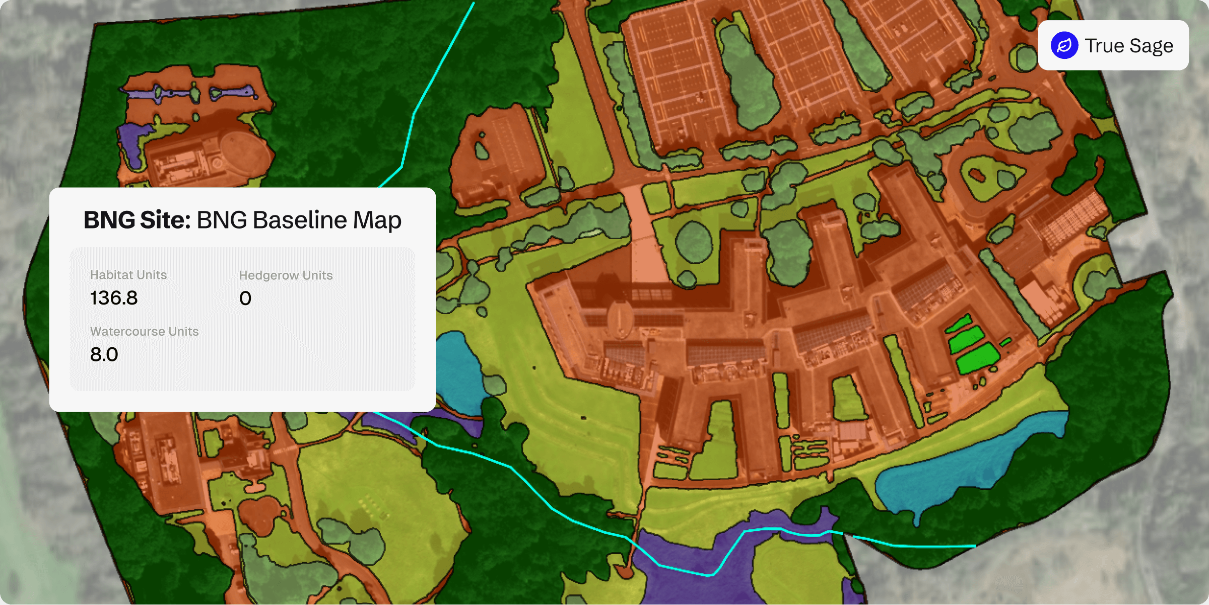
Optimise BNG reporting with precision baselines
Our surveys deliver accurate biodiversity baselines, enabling effective management and uplift of biodiversity. Track progress and drive ecological value, whether for single sites or entire portfolios.

Ensure compliance
with TNFD and CSRD
Streamline compliance with TNFD, CSRD and other global frameworks. Our rapid and remote biodiversity assessments eliminate administrative bottlenecks and reduce reporting risk.

Monitor biodiversity at scale effortlessly
Traditional surveys create bottlenecks. Gentian delivers remote biodiversity assessment software, empowering you to monitor nature intelligence across entire portfolios—seamlessly and at speed.

Secure consistent biodiversity data
Field surveys introduce variability. Gentian True Sage delivers standardized, precise habitat data for reliable benchmarking and risk modeling across sites—eliminating costly fieldwork and logistical bottlenecks.

Baseline biodiversity—past and present
Traditional surveys are limited to the present. Gentian True Sage leverages archival imagery to reconstruct precise baselines and track long-term trends—year-round, without seasonal constraints.
Biodiversity habitat map
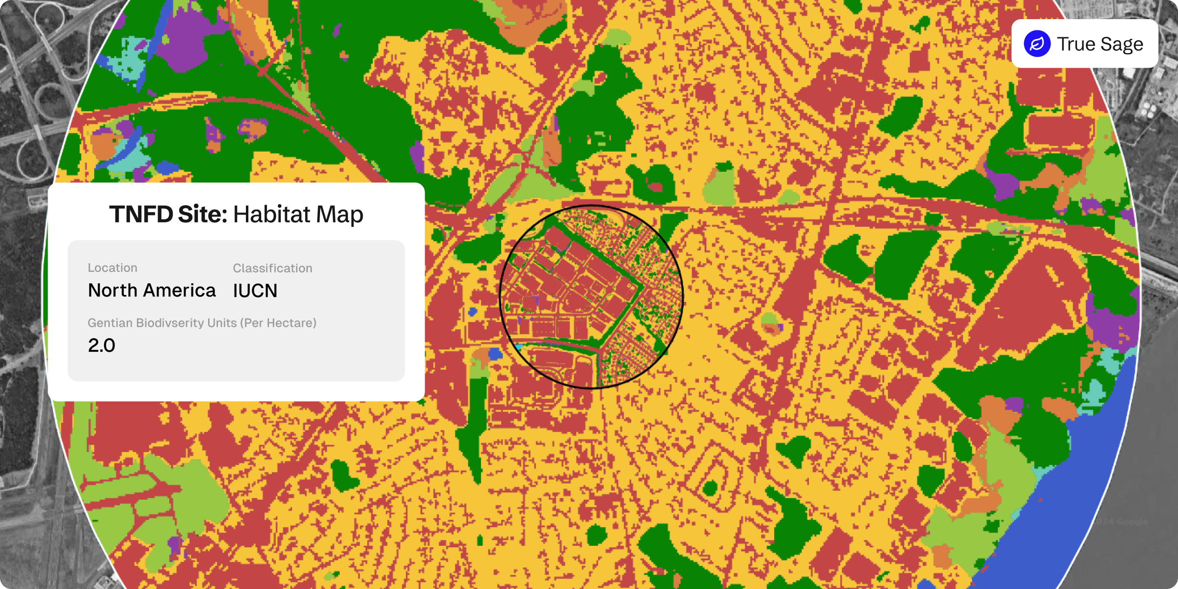
TNFD habitat map
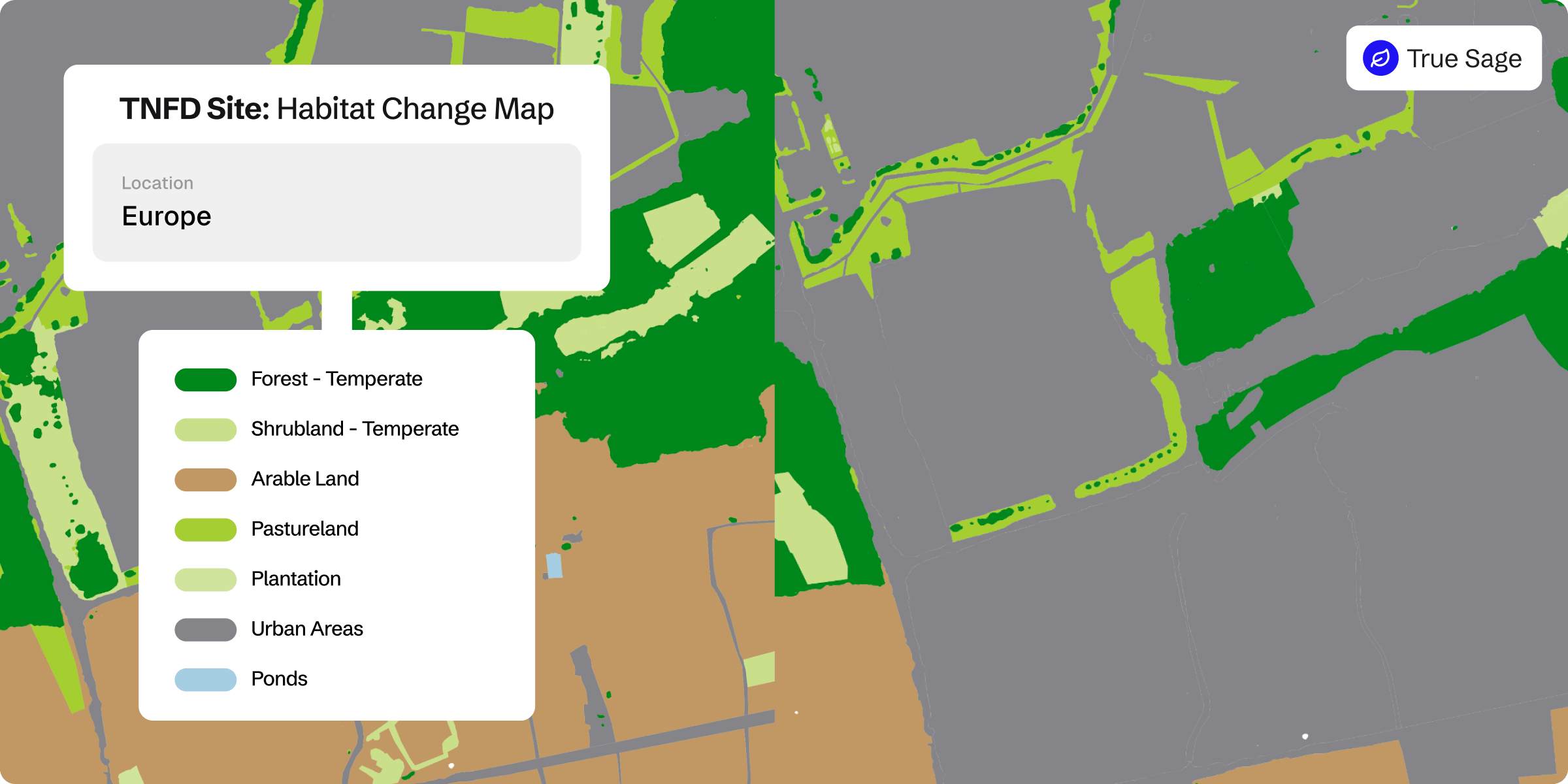
TNFD change map
Landowner transforms its biodiversity monitoring, demonstrating measurable net gains across 50+ Sites
A major operator leveraged Gentian True Sage to map 50+ sites in 90 days and verify measurable biodiversity uplift. The platform slashed overheads, streamlined reporting, and ensured scalable, evidence-based tracking.
Precise habitat mapping with expert verification
Gentian True Sage delivers habitat classifications aligned with global standards and TNFD requirements, covering a comprehensive range of ecosystems. Every analysis is rigorously verified by our expert ecologists to ensure precision and data integrity.
Comprehensive nature intelligence, including key linear features
Map habitats alongside vegetation corridors, waterways, and individual trees with precision. This ensures a complete ecological picture for risk mitigation, biodiversity planning, and biodiversity alignment.
Current, Very-High-Resolution imagery for accurate assessments
Leveraging sub-50 cm imagery captured within the year, Gentian True Sage delivers the most current habitat data available—ensuring risk and land assessments reflect real-time conditions.