
Gentian True Urban: Urban Habitat Mapping Software
Gentian True Urban is an urban habitat mapping software delivering high-resolution climate resilience and biodiversity insights for municipalities. Leveraging AI-powered analysis, it maps green infrastructure, tracks urban habitat shifts, and empowers resilient planning with precision data.
.png?width=2048&height=690&name=unnamed%20(2).png)
.jpg?width=5760&height=3840&name=mike-benna-SBiVq9eWEtQ-unsplash%20(1).jpg)
Optimize green infrastructure planning
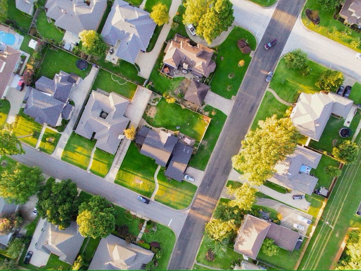
Urban biodiversity is under threat yet poorly mapped. Gentian’s True Urban software delivers remote, scalable habitat mapping to enhance climate resilience, green infrastructure, and ecological health.
.jpg?width=4071&height=2717&name=luiza-giannelli-1RIlmivtNhw-unsplash%20(1).jpg)
Accelerate climate and sustainability goals
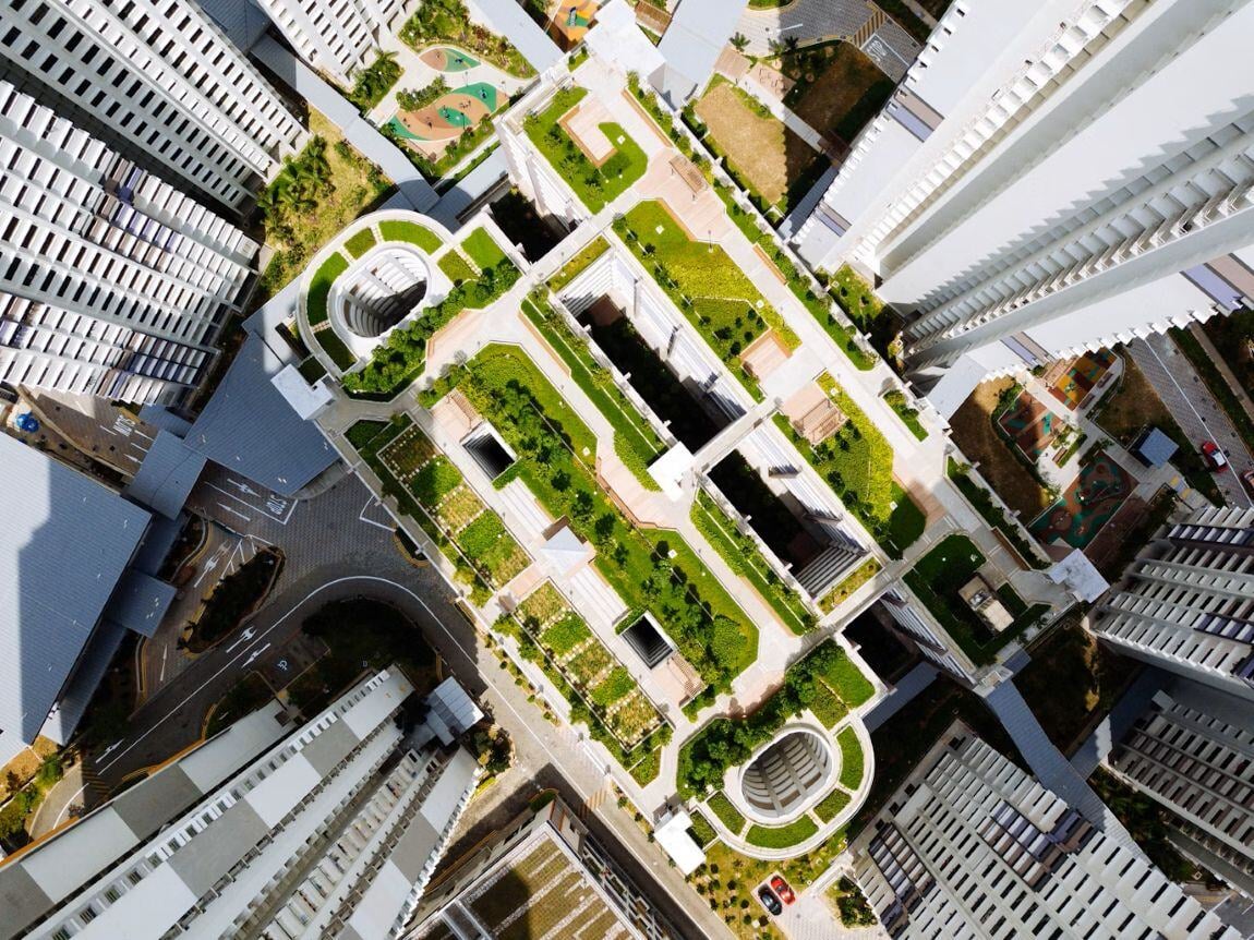
Meeting urban biodiversity targets creates bottlenecks. Gentian True Urban automates city-wide green infrastructure mapping—streamlining TNFD alignment and slashing reporting overheads.

Ensure accurate urban biodiversity data
Municipalities often lack consistent biodiversity data. Gentian True Urban automates city-wide mapping, delivering standardized, AI-driven insights—reducing overheads and accelerating resilience planning.
Monitor urban habitat change
Urban environments change rapidly, creating tracking issues. Gentian True Urban delivers automated, standardized biodiversity monitoring —empowering resilient, long-term planning.
Accelerate climate resilience planning
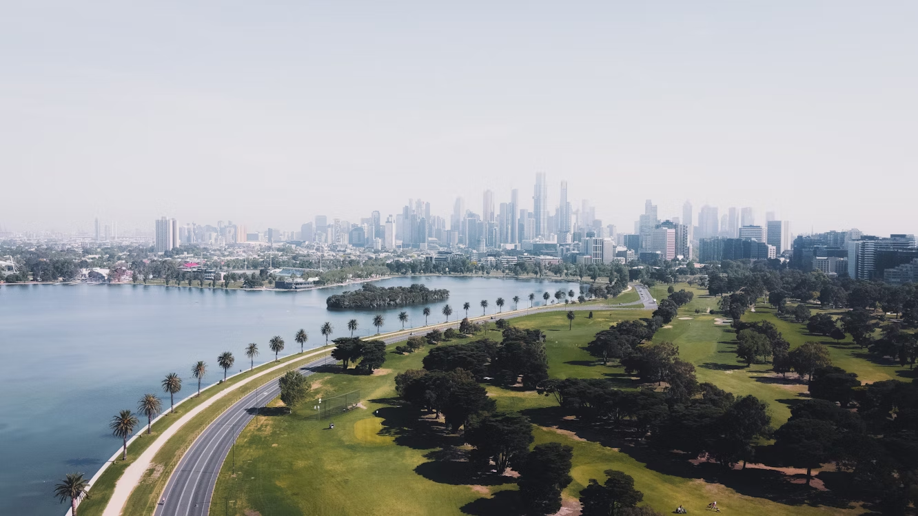
Manual surveys create bottlenecks. Gentian True Urban delivers remote, precision nature data on canopy cover, green roofs, and green infrastructure—instantly and at scale.
Power smart, sustainable growth
Balancing nature with urban growth creates challenges. Gentian True Urban delivers remote, scalable nature data—integrating green infrastructure into city planning with precision.
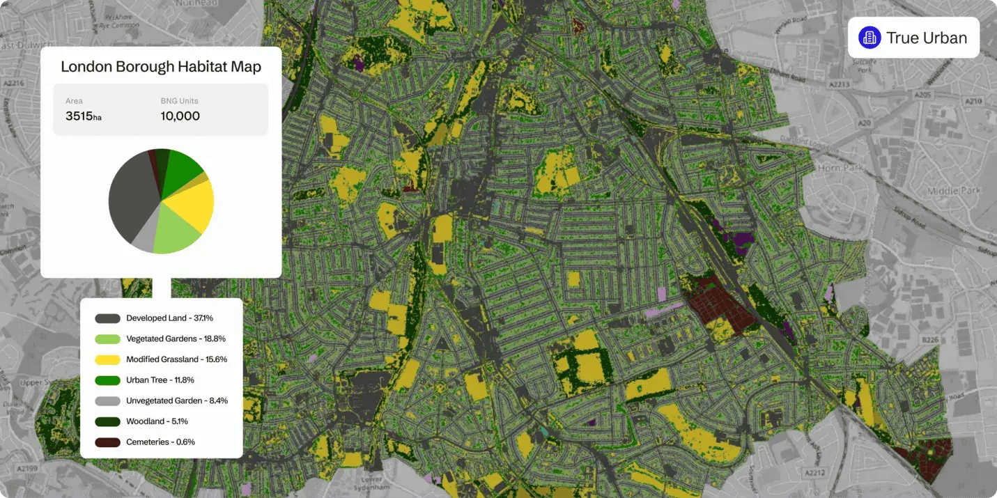
Habitat map
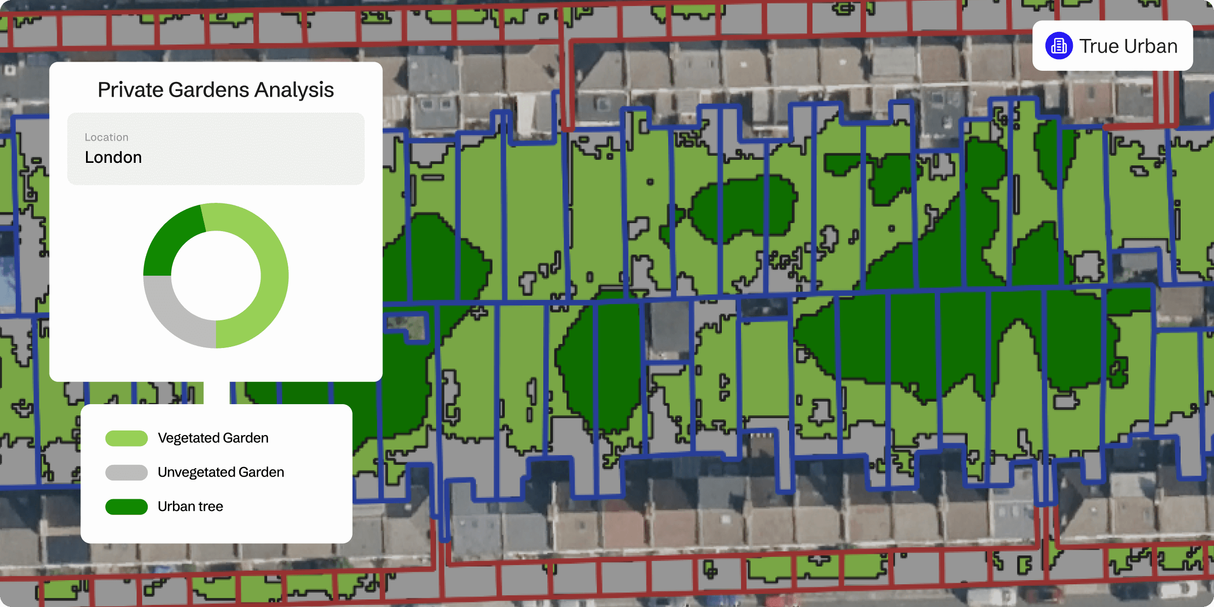
Private gardens
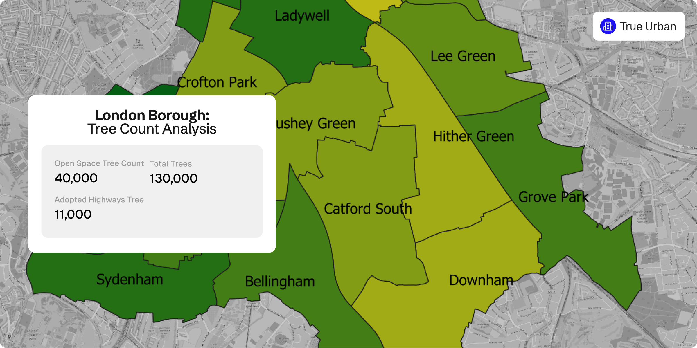
Tree count
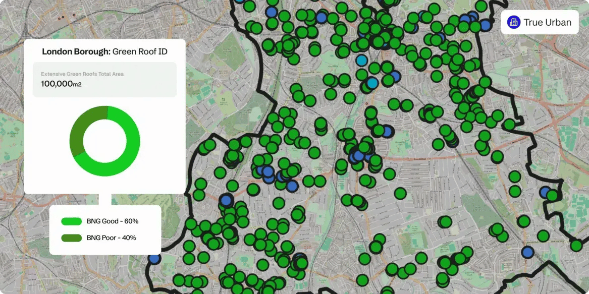
Green roof identification
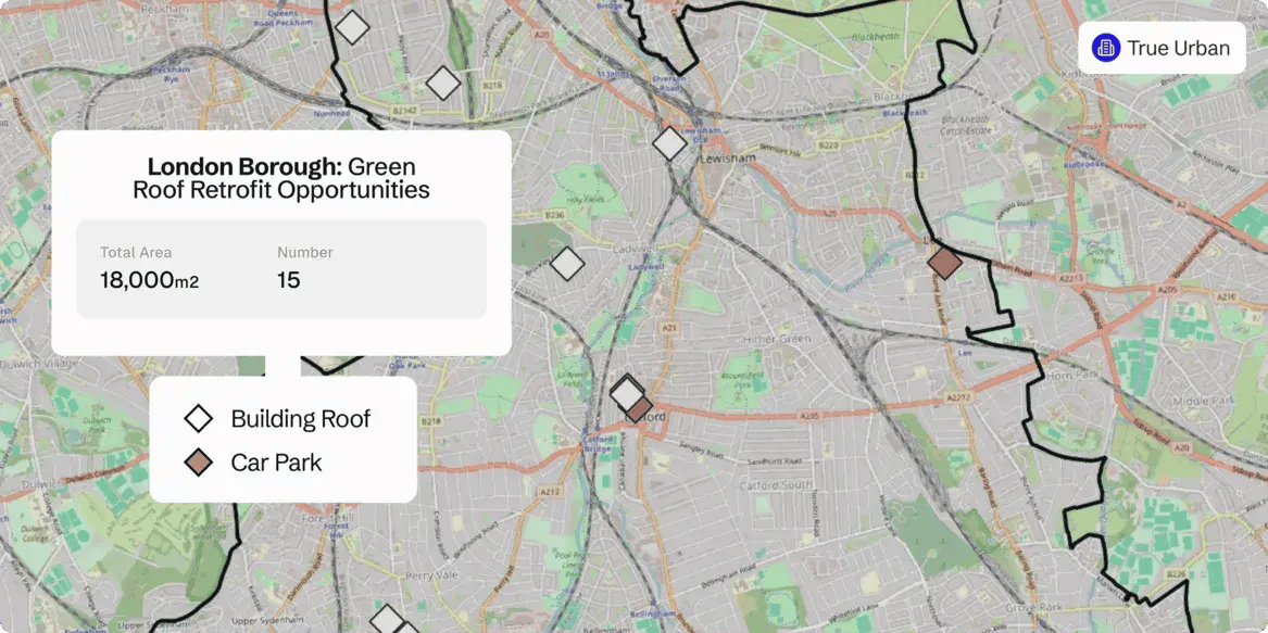
Green roof retrofit opportunities
Precise green infrastructure mapping for smarter planning
Gentian’s True Urban habitat mapping software delivers comprehensive canopy and vegetation analytics tailored to complex cityscapes. From public parks to private property, our nature intelligence empowers cities to enhance ecological value and climate resilience.
Precision green infrastructure and retrofit assessment
Leveraging sub-30 cm imagery, True Urban maps existing assets and pinpoints green roof retrofit potential—accelerating urban greening and climate resilience.
Integrate infrastructure for accurate planning
Overlay habitat data with critical urban layers—including municipal assets, rights-of-way, and parcel boundaries—to unlock a holistic view of the built environment.
Actionable intelligence for resilient cities
True Urban empowers planners, developers, and policymakers with accurate data to design resilient cities. By integrating nature intelligence with green infrastructure, it enables evidence-based decisions supporting climate adaptation and risk mitigation.