
Gentian True Sight - AI Biodiversity Planning Software
Gentian True Sight is AI-powered biodiversity planning software designed to measure ecological value and operational risk. It unlocks rapid, high-resolution habitat classifications compatible with global reporting standards (like TNFD), delivering instant nature intelligence for agile decision-making and site-scoping. Fully remote and available within minutes, True Sight scales effortlessly to help you monitor assets and build climate resilience across your entire portfolio.
Try True Sight now
Experience speed and simplicity firsthand. Log in to the Gentian Platform to start your nature intelligence journey today.
-
Download biodiversity baseline surveys in minutes, at a fraction of the cost of manual assessments
-
Ideal for site scoping and early due diligence, without the weeks-long wait
-
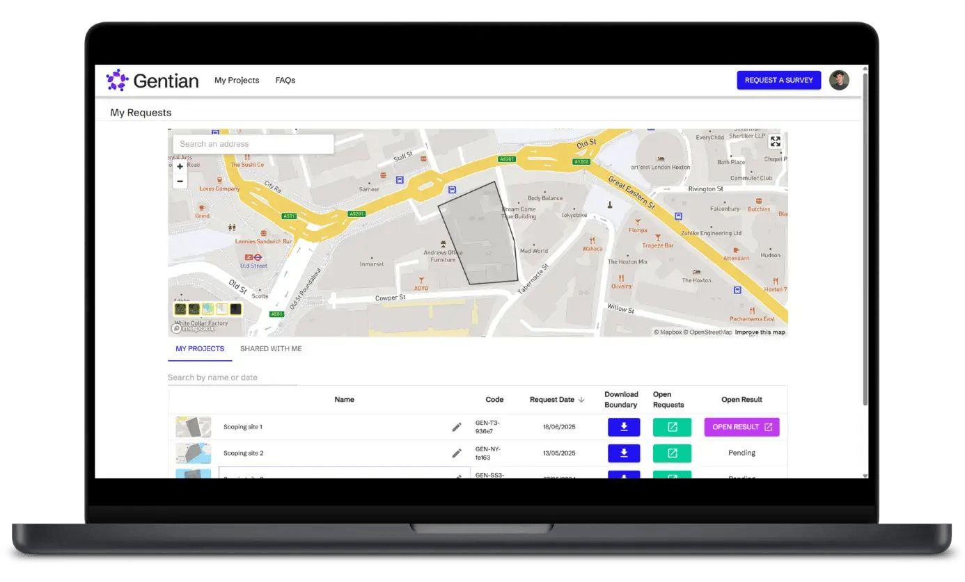
Access reports and visualize your nature data, all in one place

Accelerate site scoping and risk assessment
Gentian True Sight delivers AI-powered habitat maps in minutes—rapid, precise, TNFD-aligned, and cost-effective.

Reduce costly and slow field surveys
Traditional surveys create bottlenecks. Gentian True Sight delivers AI-powered habitat maps in minutes—rapid, precise, TNFD-aligned, and cost-effective.

Optimise large-scale site monitoring
Monitoring multiple sites drains resources. Gentian True Sight scales instantly, delivering precision habitat maps across entire portfolios in minutes.

Eliminate seasonal limitations
Field conditions constrain traditional surveys. Gentian True Sight leverages satellite imagery and AI to deliver consistent biodiversity data year-round—unaffected by seasonality.

Accelerate planning & development
Data gaps delay approvals. Gentian True Sight streamlines TNFD reporting and nature risk assessment. It integrates seamlessly into workflows, delivering instant insights to accelerate decisions and keep projects moving.

AI-driven insights for nature risk and resilience
Leveraging satellite imagery, we achieve what ground teams find impossible: remotely mapping vegetation across private property and restricted access zones.
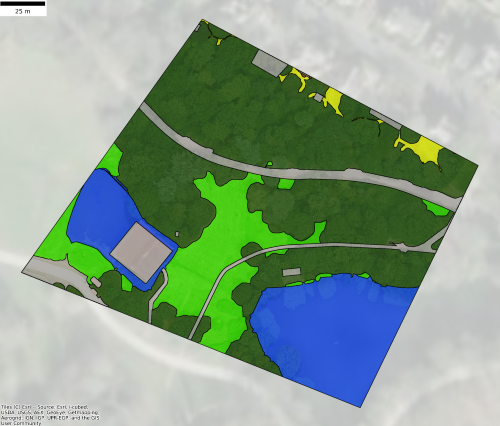
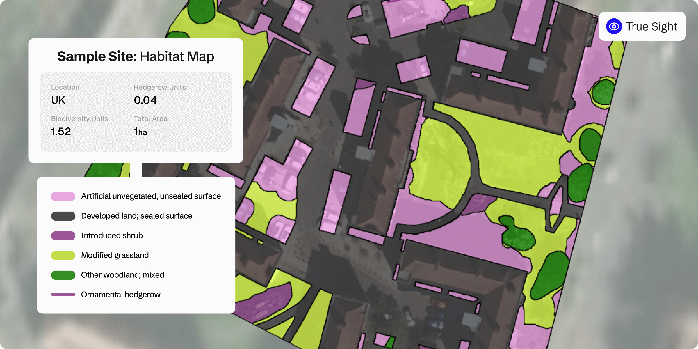
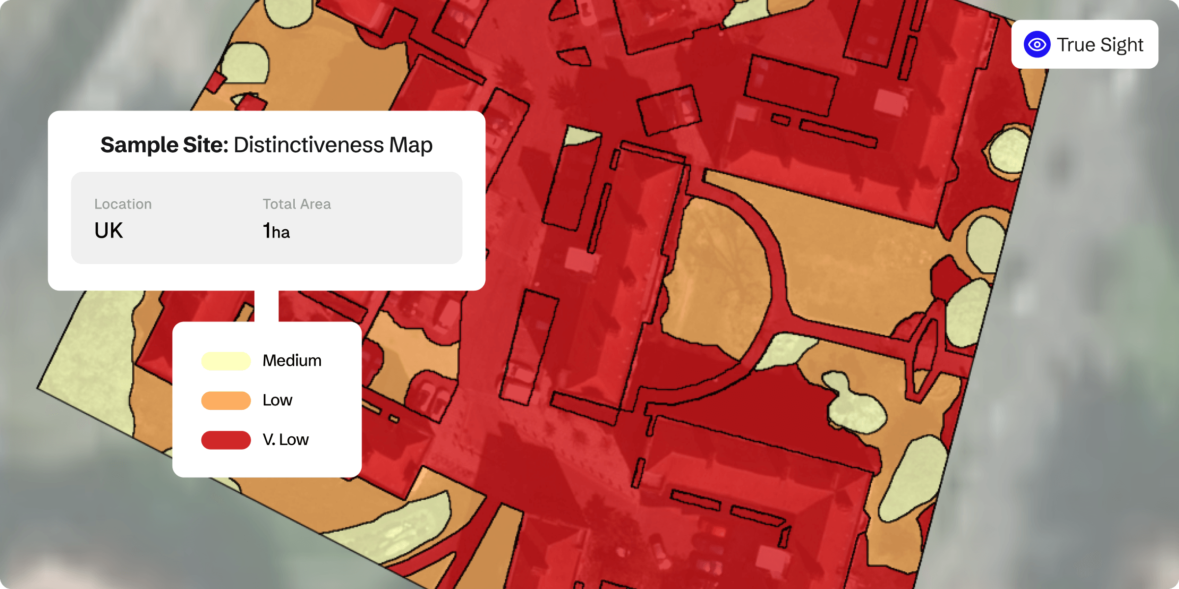
TNFD-aligned habitat map
Biodiversity scoring
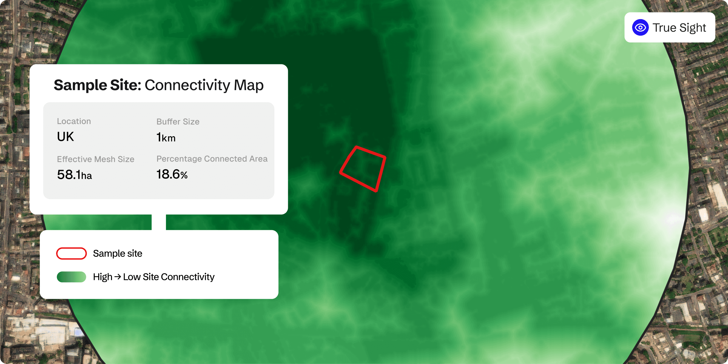
Ecological Connectivity heat map
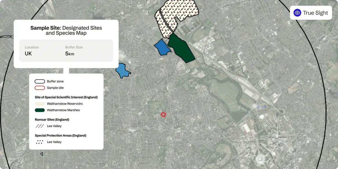
Designated sites and species
Rapid biodiversity planning software empowers facilities leaders to slash site scoping time
A leading UK facilities management company needed faster, scalable biodiversity planning software. Using Gentian True Sight, they slashed site-scoping time, reduced overheads, and optimized proposals, securing projects over the competition.

Precision habitat mapping for risk and land assessment
Gentian True Sight leverages up-to-date, Very-High-Resolution imagery—captured within the last three years, with precision as fine as 12.5 cm—to deliver exact habitat boundaries. This ensures actionable insights for risk mitigation, planning, and TNFD alignment.
Comprehensive habitat classification with critical linear features
Our advanced biodiversity planning software identifies over 35 habitat types, integrating both common and critical ecosystems. It captures essential linear features, such as vegetation corridors and watercourses, providing a complete ecological picture for informed decision-making.
Automated biodiversity metrics for reporting and risk
Automatically calculate biodiversity metrics with precision using our advanced classification models. This streamlined approach supports TNFD alignment, risk modeling, and habitat restoration strategies with minimal manual effort.
API-enabled access for seamless enterprise integration
Easily integrate Gentian True Sight’s habitat and biodiversity data into your existing workflows via our API. Gain real-time access to actionable insights, ensuring smooth interoperability for developers, risk officers, and environmental professionals.
