Remote sensing is the science of obtaining information about an object or area from afar, typically using satellite technology, without making physical contact.
In the context of habitat mapping, this means satellites and aerial sensors can survey ecosystems from above, identifying habitat types and changes without setting foot on the ground.
This capability comes at a critical moment: over 75% of the world’s terrestrial habitats are now classified as degraded and one million species face extinction, making biodiversity loss a global crisis.
Organisations are under pressure to quickly and accurately assess nature-related risks and opportunities for emerging compliance frameworks like the Taskforce on Nature-related Financial Disclosures (TNFD) and the EU’s Corporate Sustainability Reporting Directive (CSRD).
Yet, traditional habitat mapping methods struggle to meet these needs, they’re slow, costly, and can lack the detail and scale required for confident decision-making. Fortunately, remote sensing offers a transformational solution. In this blog, we explore what remote sensing entails and why it’s becoming the new standard for habitat mapping.
We’ll compare traditional versus cutting-edge approaches, highlight how Gentian’s ecology-driven AI achieves high-confidence habitat classification, and show how this technology provides the speed and scalability needed for critical environmental decisions.
Jump to Section:
- What is Remote Sensing?
- Why Traditional Habitat Mapping Fails at Scale
- The Precision of Remote Sensing: The New Standard
- Unmatched Speed and Scalability for Critical Decisions
By understanding these advancements, environmental consultants, sustainability officers (CSOs), and risk managers (CROs) can see how Gentian’s precise data platform addresses their biggest pain points, delivering fast, scalable, and standardised biodiversity insights to meet compliance obligations and manage risk with confidence.
What is Remote Sensing?
Remote sensing is the acquisition of information from a distance, observing and measuring objects or areas without direct contact. In practice, it refers to using satellite technology to detect and classify features on Earth’s surface.
For a more in-depth explanation of remote sensing, we recommend reading our dedicated article on the topic, where Olga Tutubalina, our Remote Sensing Senior Expert, provides detailed insights.
Essentially, sensors capture electromagnetic signals (like reflected sunlight or emitted radar) and convert them into data. For example, NASA uses satellites and aircraft to monitor Earth’s climate, land cover, and ecosystems from space.

Crucially, remote sensing provides a global, bird’s-eye view that ground methods cannot. Different types of sensors (optical, infrared, LiDAR, radar, etc.) can reveal various environmental characteristics. By analysing satellite imagery, we can map forests, water bodies, urban areas, and more with remarkable detail.
In habitat mapping, remote sensing allows us to identify and delineate habitat types across wide areas quickly and consistently.
High-resolution imagery and advanced algorithms mean we can classify vegetation and land cover types over landscapes without ever needing to physically step into each location.
This sets the stage for the next section: why older, boots-on-the-ground mapping struggles to keep up.
Why Traditional Habitat Mapping Fails at Scale
Traditional habitat mapping relies on ecologists conducting field surveys, literally walking through sites to observe and record habitats.

While on-ground expertise is invaluable, and we believe the work ecologists do provides essential context and ecological judgement in many contexts, the field survey this approach faces serious limitations when scaling up to large areas or tight deadlines, especially under new TNFD and CSRD compliance pressures.
Below we break down the key pain points of manual surveys and their consequences:
Time-Consuming and Costly
Mapping habitats by hand is inherently slow and labour-intensive. Even a single large site (>~10 hectares) can require weeks of fieldwork to survey and map.
Multiply that by dozens of sites across a regional or global portfolio, and projects can stretch on for months. While on-ground ecological expertise remains critical, especially for providing context and judgment, manual surveys struggle to deliver timely data at scale.
By contrast, remote sensing approaches can cover similar areas in a fraction of the time and cost, as we’ll see later.
Extended Project Timelines
One reason is seasonal limitations: ecologists typically need to survey during spring or summer when plants are identifiable, meaning a narrow window each year.
If a project misses this window or needs follow-up surveys (e.g. for protected species), it can face delays of several months until the next season.
While the judgment of ecologists is irreplaceable in complex habitats, these timeline issues make it nearly impossible for multinational companies and their consultants to get up-to-date, repeatable data across all operations, yet frameworks like TNFD/CSRD demand exactly that.
Inconsistent Data and Localised Expertise
Manual habitat surveys are also prone to inconsistency. Different ecologists may interpret habitat types or boundaries differently, and individual judgment can influence results.
In fact, traditional methods often produce different outcomes even when two seasoned ecologists survey the same location simultaneously, as each expert’s personal experience and judgment affect the mapping.
While field-based ecological insight is invaluable, its subjectivity and lack of standardisation can create serious challenges for compliance reporting.
Such variability undermines confidence in the data and complicates reporting for compliance. Consistent, objective measurements are needed, which is where a technology-driven approach can excel.

Remote sensing technology provides granular, standardised, and up-to-date habitat data that large organisations now need for TNFD and CSRD compliance. This sets the stage for a new standard in ecological data gathering: precision remote sensing.
For more information on TNFD and CSRD compliance please visit our guide on the subject.
The Precision of Remote Sensing: The New Standard
Gentian’s remote sensing approach to habitat mapping is redefining standards by delivering a level of precision and efficiency unattainable with traditional methods.
By combining advanced satellite imagery with ecology-driven AI, Gentian provides habitat maps that empower confident, impactful decisions based on high-quality data.
Below, we contrast the standard field-based approach with Gentian’s remote sensing approach to highlight how the latter is raising the bar for accuracy and scale:
|
Aspect |
Traditional Habitat Mapping |
Gentian’s Remote Sensing Approach |
|
Data Collection |
Conducted by trained ecologists with deep field expertise; provides rich ecological context and first-hand observation. However, coverage is limited in remote, dangerous, or inaccessible areas. |
Satellite and aerial imagery capture 100% of the area, including hard-to-access sites, with no physical presence needed. |
|
Level of Detail |
Ecologists can detect subtle cues (e.g. rare species, soil conditions). Relies on human observation; mapping units often coarse (depends on mapper’s notes). Fine features may be missed. |
Very high resolution imagery (<50 cm) resolves small features. Can distinguish individual trees and small habitat patches, ensuring no detail is overlooked. |
|
Speed & Scalability |
Enables ground-truthing and ecological interpretation but is time-intensive, large sites take weeks or months. Hard to scale due to manpower limits. |
Fast and scalable – automated AI analysis delivers results in days, even for dozens of sites. Mapping 50+ sites in 90 days is now achievable. |
|
Data Consistency |
Rich in ecological insight, but outcome varies by surveyor; subjective judgments cause inconsistent classifications. Data spread across reports, not standardised. |
Standardised outputs – AI applies the same classification rules everywhere. Results are quality-checked for consistency, giving a unified data set across regions. |
|
Compliance Readiness |
Manual data often needs reformatting to fit reporting frameworks (risk of gaps or errors). |
Framework-aligned – Habitat types are classified to recognised standards (IUCN, UKHab, EUNIS) from the start, yielding audit-ready data for TNFD, CSRD, BNG, etc. |
In the sub-sections that follow, we delve deeper into the pillars of this new standard: the technology enabling habitat mapping using remote sensing, the unique fusion of ecology and AI expertise, and the rigorous accuracy in habitat classification that together instill trust in the results.
Habitat Mapping Using Remote Sensing
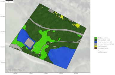
Traditional satellite mapping isn’t new, but Gentian pushes it to new heights of precision. We utilise very high resolution (VHR) satellite imagery with spatial resolution better than 50 cm per pixel.
In practical terms, this means our system can detect features smaller than 0.5 m on the ground, enough to identify individual trees.

This level of detail enables the detection of small-scale disturbances (e.g. selective logging, isolated habitat degradation) that would be invisible to coarser mapping methods. Identifying these fine changes is essential for establishing accurate baselines and monitoring year-to-year habitat trends.
Achieving such detail at scale requires more than just sharp imagery; it demands robust processing and quality control. Gentian’s workflow includes meticulous multi-stage quality assurance on every dataset.
First, our proprietary AI models automatically classify habitats from the imagery.
Then, for our premium products (True Sage, True Oracle and True Urban) a human-in-the-loop review by our in-house ecologists checks the outputs for plausibility and local context.
By fusing cutting-edge tech with thorough validation, Gentian delivers habitat maps that are not only incredibly detailed but also reliable as a foundation for environmental assessment.
Ecology-Driven AI
Gentian’s core strength lies in the fusion of technology and ecology. Our remote sensing platform is built on proprietary deep learning algorithms, but unlike generic tech solutions, it has ecology baked into its DNA.
The AI has been developed hand-in-hand with leading experts in biodiversity and Earth observation, ensuring that its design and training reflect real ecological patterns (not just pixel statistics).
The result is an AI that doesn’t operate as a “black box,” but rather as a digital ecologist, interpreting imagery in ways a human expert would, only much faster.
This ecology-driven AI means that every insight is grounded in science. For example, the models recognise not just differences in green pixels, but what those differences mean in habitat terms, distinguishing a wet meadow from a dry grassland, or a native woodland from a commercial plantation.

By incorporating field data and ecological theory into model training, Gentian’s AI bridges the gap between raw technology and real-world ecology.
Moreover, our team of PhD-level experts and remote sensing scientists (with decades of combined experience) continuously monitor and enhance the system.
We validate AI outputs against on-the-ground observations and update the models as new ecological information emerges.
This synergy of AI prowess and ecological expertise sets Gentian apart, delivering insights that are not only high-tech, but ecologically meaningful and tailored to the complexities of natural habitats.
Accurate Habitat Classification for Trust
When it comes to habitat mapping, accuracy and standardisation are paramount. A map is only as useful as it is correct, especially if it’s informing high-stakes decisions or regulatory disclosures. Gentian tackles this head-on with an approach centered on robust habitat classification.
Our AI models are trained to identify a wide variety of habitat types (from forests and wetlands to heathlands and urban greenspaces) using globally recognised classification systems.
In particular, we align our outputs to frameworks like the IUCN Global Ecosystem Typology, the UK’s UKHab (UK Habitat Classification), and Europe’s EUNIS habitat system.
This means that whether you’re assessing a site in London or a landscape in Southeast Asia, the habitat categories in our data adhere to well-defined standards that ecologists and regulators understand.
By classifying habitats according to these established taxonomies, Gentian ensures apples-to-apples comparisons and compatibility with reporting requirements.
For example, UKHab and EUNIS codes allow direct integration with biodiversity net gain (BNG) calculations or assessments, while IUCN categories support global consistency. Adhering to such standards is not just academic, it builds trust.
Clients and stakeholders know that our data has been benchmarked against authoritative criteria, making it credible. In fact, under emerging rules like CSRD, companies’ biodiversity data must be “auditable” and follow recognised metrics.
At Gentian, we uphold high classification standards through a robust Quality Assessment process. Our habitat maps are designed with traceability in mind, every polygon is linked to a defined habitat type, and our QA workflow includes cross-checking with other trusted datasets to validate accuracy and consistency at the local level.

By delivering precise, standardised, and trustworthy habitat classifications, Gentian’s remote sensing solution provides the solid foundation needed for compliance reporting and proactive biodiversity management.
Unmatched Speed and Scalability for Critical Decisions
One of the greatest advantages of remote sensing for habitat mapping is the speed at which insights can be obtained, and the ease of scaling those insights to any geography. Gentian’s approach exemplifies this efficiency.
By replacing manual surveys with AI-driven analysis of up-to-date satellite images, we deliver habitat insights in days, rather than the weeks or months that field surveys would require.
In practical terms, what might have been a 3-month survey campaign can often be compressed into a couple of weeks of processing.
This dramatic time savings (an up to 75% reduction in turnaround time) allows environmental teams to move from data collection to decision-making much faster.
Equally important is scalability. Whether you need to map a single field or an entire country, Gentian’s solution can scale to the task. Because our analysis is cloud-based and not limited by human travel, covering a larger area mainly means processing more imagery, something our platform is designed to handle in parallel.

We’ve delivered projects ranging from local 10-hectare conservation sites to national portfolios of 50+ sites in one go.
The data is consistently processed, so results are comparable across all sites, enabling enterprise-level rollups of biodiversity metrics.
This flexibility allows consultancies and corporations to meet diverse needs: you can just as easily commission a habitat map for a prospective solar farm site as you can for an entire county’s landholdings, with quick turnaround in each case.
Gentian also recognises that speed is only valuable if the data can be seamlessly integrated into your workflow. That’s why all our habitat maps and analytics come in GIS-compatible formats (geospatial files, databases) and via APIs for direct integration into client systems.
This means no time wasted on format conversion or manual data entry, the outputs drop straight into your existing GIS, dashboard, or reporting tool.
By automating the data pipeline, we reduce time spent on data wrangling and eliminate manual inconsistencies. In short, the combination of rapid analysis, scalable coverage, and plug-and-play data delivery empowers teams to make critical environmental decisions with unprecedented agility.
Whether it’s prioritising conservation actions, reporting to regulators, or safeguarding assets from climate risks, a remote sensing approach provides the timely, big-picture insight needed to act decisively.
At Gentian, our mission is to equip businesses and policymakers with actionable biodiversity intelligence.
The biodiversity crisis and the rise of nature-related disclosures demand a fundamentally new approach to habitat mapping, one that delivers precision, speed, and scale all at once.
Remote sensing has emerged as that solution, and Gentian is at the forefront of turning its potential into practical outcomes.
The precision of our remote sensing-based habitat mapping means you can trust the data to inform critical decisions, whether it’s balancing development with conservation, monitoring climate impacts on your assets, or demonstrating progress towards nature-positive goals.
We invite you to explore how our innovative remote sensing solutions can enhance your environmental strategies and risk management.
To discover what Gentian’s remote habitat mapping can do for you, we encourage you to get in touch or learn more about our Habitat Mapping services.
Together, we can harness the power of precision data to drive smarter decisions and contribute to a more sustainable future.
.png?width=400&height=250&name=Untitled%20(70).png)