The Challenge for Utility Leaders
Utility companies face rising environmental and operational risks amid climate uncertainty.
Wildfires, once seasonal, now burn year-round, severe storms have driven an 80% rise in weather-related outages over the past decade, and prolonged droughts are straining ecosystems and infrastructure.
Meanwhile, new regulations like TNFD and CSRD demand transparent disclosure of nature-related risks, reflecting stakeholder and investor expectations.
Balancing resilience with tight budgets is daunting. Gentian offers an innovative path forward: by blending deep ecological expertise with advanced AI, we enable proactive risk management to meet these challenges head-on.
Precision Data: The Foundation of Utility Resilience
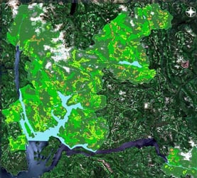
Gentian’s Very High Resolution (VHR) satellite imagery and AI provide the precision data foundation for climate resilience, offering unmatched detail, even distinguishing individual tree canopies and health indicators.
This precision environmental intelligence makes utility risk mitigation more effective by pinpointing areas of concern.
Gentian delivers unmatched accuracy, revealing overlooked details and empowering confident decisions.
Key applications include:
- Wildfire Prevention: Monitoring transmission line corridors to spot overgrown or unhealthy vegetation before it contacts power lines.
Vegetation is a leading cause of outages and utility-sparked wildfires, so high-resolution alerts let crews trim branches before they ignite a blaze.
- Drought and Damage Detection: Identifying drought-stressed areas and fallen trees on utility landholdings that threaten infrastructure.
By detecting early warning signs like drying vegetation or storm-toppled trees, utilities can intervene before these issues cause outages or damage.
This granular insight enables proactive decision-making long before issues become critical, ensuring business continuity.
Speed, Scalability, and Seamless Integration
Unmatched Speed and Ease
Gentian’s platform provides actionable insights at unmatched speed. Instead of waiting weeks for field surveys, our AI-powered analyses deliver results within days, sometimes hours, of acquiring satellite data.
This speed is crucial for risk management, allowing utility teams to react quickly to emerging threats like encroaching wildfire risks or unstable trees.
Rapid turnaround also means you can meet tight compliance and reporting deadlines with ease.
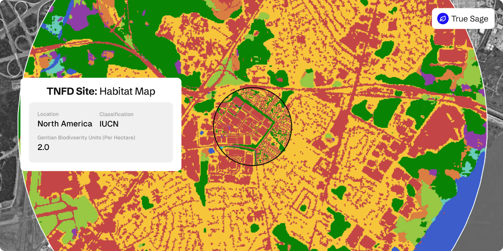
Complex tasks like TNFD-aligned habitat assessments that once took months can now be completed far more rapidly, keeping your organisation ahead of the curve.
Scalable and Seamless Integration
Gentian’s solutions scale effortlessly from a single site to multi-site monitoring projects across vast geographic areas.
For example, Scottish Power used Gentian’s remote assessments to achieve 100% site coverage while cutting monitoring costs by 50%.
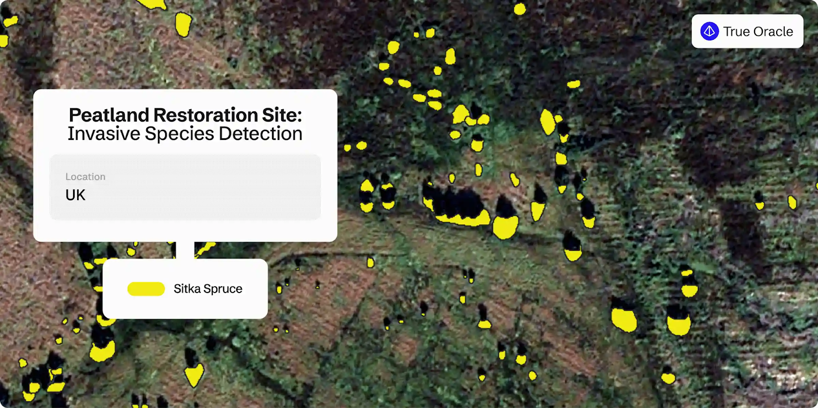
We developed a custom peatland monitoring solution using Gentian True Oracle.
By integrating high-resolution satellite imagery and AI-driven analysis, the solution provided full-site assessments in days, identifying degradation, invasive species, and restoration success.
Our software is built for enterprise integration, fitting smoothly into existing workflows:
- GIS Compatibility: All maps and data outputs are delivered in standard GIS formats, so they plug directly into your current systems for asset management and environmental monitoring.
- API Integration: Programmatic access via our API allows you to automate data updates and incorporate Gentian’s insights into your enterprise risk management platforms in real time.
By providing compliance-ready data aligned with reporting frameworks like TNFD, Gentian also simplifies complex regulatory burdens.
Scalable cloud processing and fully remote data collection mean no fieldwork delays or seasonal constraints.
Whether you need a quick-turnaround site survey or continuous monitoring across hundreds of miles of power lines, Gentian’s technology adapts to your needs, ensuring you meet and exceed resilience and compliance requirements.
Partnering for a Resilient Future
Gentian is more than a data provider, we are a trusted partner committed to building a resilient future. Our approach is built on a blend of ecological expertise and advanced AI, making the invisible visible by illuminating hidden environmental risks.
Harnessing our precision remote sensing and ecological insight lets you reduce risk, fulfil regulatory obligations, and strengthen resilience.
Gentian’s actionable intelligence helps you anticipate threats and safeguard your assets and surrounding ecosystems, ensuring your operations stay protected.
Ready to transform your risk strategy?
Contact us to learn how Gentian’s precision environmental intelligence can fortify your utility landholdings against environmental risks.